Friday 30 August 2019

Glyndwr's Way : 2

Certainly a pretty part of the world, this.
I head back east from Machynlleth - I almost got to the coast, in fact I may just about have seen the sea in the distance.  I seem to be getting into slightly more inhabited parts, by which I mean, some of the valleys contain tiny villages, often even with a small shop.  Had I known these were there I could have planned to resupply, but it seems this is a part of the world that internet mapping sites are still unaware of...

Pretty though, and the weather just about holds up, it rains a little most days, and quite a lot at night, but decent walking weather really, all good fun, and I am even enjoying the luxury of proper campsites each evening now.  The first of these is essentially a farm in the middle of nowhere, but after that I get actual pubs with beer, wouldn't be much of a walking trip without these things.

Some of the many random bits of cloth and crochet decor in Meiford.
I continue towards the English border, not too far now, the terrain growing flatter and increasingly forested, I walk on gravel logging tracks much of the time.  Still not seeing many walkers - at one campsite I'm told they do get a lot of people doing it - as much as one or two every month!  Hmm.  People also tell me this is a tough walk, can't say it seems so to me.  Certainly not a terribly long one, I finish the thing in a little less than eight easy days, arriving in Welshpool in plenty of time to get my train.  In fact the train is cancelled, oh well, time for a bit of shopping and a beer before the next one.

Well, this was a good walk anyway, certainly recommended to anybody wanting to get away from it all!  I think the wild camping could be avoided if you were willing to fork out B&B prices, though personally I quite like being by myself in a wood for a night or two.  Do be prepared to get wet though - I think I was quite lucky with the weather, but even so I had a fair bit of bog to walk through.

I succeeded again!
Photos to go with this post can be found here.

Tuesday 27 August 2019

Glyndwr's Way : 1

Ruined Bryntail Lead Mine, with the Clywedog Dam on the River Severn behind.
Still in the UK, in what passes for summer in these benighted islands, it seems like a good idea to do another of the National Trails.  I settle on Glyndwr's Way, in mid Wales, finishing in Welshpool this will be handy for a festival I'm going to in nearby Shrewsbury.  I can't say this is a part of the world I'm that familiar with, so, nice to see somewhere new.

Starting from Knighton in Herefordshire, the route heads west through lovely countryside, rolling hills and valleys, and easy enough going, the trail seems to mostly be accessible to horses so not too steep.  I do meet one horse rider, and just a few walkers, several say I am the only hiker they've seen, this is not a busy trail.  Often there is no sign of a walked path across the sheep-filled fields, but there are plenty of signs, with that and my GPS I stay on track.

A representative shot of me, with Welsh countryside, light rain and sheep.
This doesn't seem a very well populated part of the world either...  Not exactly wilderness, above a certain height the fields give way to moorland, still with plenty of sheep, but most of this country is farmland, with little in the way of towns or villages.  I do enjoy a beer and burger in Llanidloes, no campsite though, in fact I camp wild my first four nights in Wales.  At least on the fourth night I have a couple of cans of beer from the second place on the Way with actual shops, Machynlleth.  More or less half way along the route, this is where Welsh hero Owain Glyndwr, for whom the Way is named, held his parliament as he briefly ruled an independent Wales at the turn of the fifteenth century.

Site of Owain Glydwr's parliament in Machynlleth.
Photos to go with this post can be found here.

Saturday 13 July 2019

Munro Madness : 6

Munros this section :
Cairn Bannoch
Broad Cairn
Tolmount
Tom Buidhe
Cairn of Claise
Carn an Tuirc
Glas Maol
Creag Leacach
Carn Aosda
The Cairnwell
Carn a' Gheoidh
An Socach (Glen Ey)
Carn Bhac
Beinn Iutharn Mhor
Carn an Righ
Glas Tulaichean
Carn nan Gabhar (Beinn a' Ghlo)
Braigh Coire Chruinn-Bhalgain (Beinn a' Ghlo)
Carn Liath (Beinn a' Ghlo)
Beinn Dearg
Carn an Fhidhleir
An Sgarsoch
Carn a' Chlamain

Tom Buidhe.
I enjoy another day off in Braemar, this time I buy a ticket to enter the newer of the two castles, fascinating place still fully furnished in fifties aristocratic style.  I have another tough section coming up, some twenty Munros - including one I missed during planning - and a hundred and twenty kilometres in four days...  In the event I make remarkably short work of the first day, powering over six, count 'em Munros before 5pm.  A nice, if breezy day too, makes for fun walking, and I do feel a certain sense of achievement too.  I am a lean, mountain climbing machine, oh yes.   Definitely earned the burgers I've brought from Braemar - what?  Of course they can be cooked on a camp stove.

Glas Maol.
I begin the next day by climbing Glas Maol, which brings back memories - this was my first ever Munro, I came here during, hard to believe though it may seem, a golfing holiday.  After a few days I was quite heartily sick of golf, so climbing a big hill was a great improvement!  This time I follow it up with four more, all close to the Glen Shee ski centre, which is handily open for lunch.  More familiar hills too, did them on a proper walking holiday a few, well, many years back - well, no harm going up them again.  The next day is very hard, another five Munros, this time I think over five thousand feet of ascent in total, it takes over twelve hours and I am pretty shattered by the end.  Then one more day to get to Blair Atholl, only three Munros, but it rains all day, this does not help. My thighs chafe in my wet trousers - think I can see why they wear kilts around here - it is not much fun.  At least on reaching Blair Atholl, I find it has pizza, in an odd place, a pub in a marquee, a venue for beer festivals and live music it seems, but not tonight.

Beinn Dearg.
No time for a day off, but I am reaching the end of the trip, just two days to go.  I walk out of Blair Atholl past Blair Castle, there are lots of private road signs, typical of Scotland.  Three Munros today, it is hard work, a lot of trackless hacking through bog, I keep going, quite tired now, but the end is in sight, indeed this is my last night camped out on the hill.  And the last day is easy enough, just a single Munro, bringing the count to seventy-seven I think, go me.  Back to Blair Atholl where I have definitely earned a burger plus a beer or five... shame about the 7am train the next morning but what can you do.

Carn a' Chlamain.
Photos to go with this post can be found here.

Friday 5 July 2019

Munro Madness : 5

Munros this section :
Mount Keen
Driesh
Mayar
Cac Carn Beag
Carn a' Choire Bhoideach
Carn an t-Sagairt Mor

Mount Keen.
Braemar is a good place for a day off - so good, I'll be back for another in a few days time.  There are two castles, the ancient ruins of Kindrochit, and the imposing seventeenth century Braemar Castle.  And cheap beer in the Invercauld Arms, all good.  I have an easy section now - compared to the last one at least.  I'm heading east towards the isolated Munro, Mount Keen, so my first day has no climbing at all, in fact it's a familiar route past Balmoral, I came this way on my walk from Inverness to Aberdeen a few years back.  This time on reaching Ballater I check out its second curry house - also good!

Mayar.
From Ballater I have a simple enough day, over thirty kilometres but good paths and just a single Munro, lonely Mount Keen - there's a fine panoramic view from the top.  Turns out there is another stiff climb, over a thousand feet out of Glen Lee, then I find a camp spot in a high valley far from anywhere.  Two more Munros the next day, the evocatively named neighbouring peaks Driesh and Mayar, ascending the first of these the path on my map seems not to exist in reality, instead there is just a scarily steep slope that I am very glad to reach the top of.  Plenty of other climbs too, out of deep glens, this section is not as easy as I had hoped, still I am getting through it.  At least I seem to have stopped breaking things, touch wood.

Cac Carn Beag.
My return to Braemar is surprisingly easy, given there are three Munros, including the peak of Lochnagar, or Cac Carn Beag as it is properly called.  A bit of a treat for me up there too, I'm just passing the lesser summit, Cac Carn Mhor, when the Red Arrows  fly by in formation, very cool.  I think I've built some muscles, as I power up the climbs and reach camp before 5pm, all good.  Maybe I was hurrying a bit as the weather has turned again, back to howling arctic wind.  Or maybe I just wanted to get back to the pub...


Photos to go with this post can be found here and here.

Sunday 30 June 2019

Munro Madness : 4

Munros this section :
Braeriach
Sgor an Lochain Uaine
Cairn Toul
The Devils Point
Beinn Bhrotain (two ascents!)
Monadh Mor
Carn a' Mhaim
Ben MacDui
Cairn Gorm
Bynack More
Beinn Mheadhoin
Derry Cairngorm
Beinn a' Chaorainn (Glen Derry)
Beinn Bhreac (Glen Derry)
Beinn a' Bhuird
Leabaidh an Daimh Bhuide (Ben Avon)

The Devils Point.
I've not done a great job of planning this next section - a hundred and sixty kilometres in five days, fine on flat terrain, but with many huge hills to climb, plus the need to find somewhere sheltered at a lower altitude to camp, it seems impossible.  But perhaps I can find some shortcuts, we'll see.  Things start OK at least, a long ascent of Braeriach, well over four thousand feet, then three more Munros, all in cloud except the last, the Devils Point.  Warm enough and dry though, and if I don't reach camp until eight, so what, still plenty of daylight left.  Lots of people here, both camped and in a small stone hut or 'bothy' - it even has a toilet!

Ben MacDui - second highest point in Britain!
Day two out of Aviemore, beautiful blue skies, it is actually hot and I need to filter water - well, not hard to find up here.  I manage the planned two Munros, ascending one of them twice in fact - still better than my original route which had me backtracking from the Devils Point over two big hills.  But, I'm only at the fifty kilometre point at the end of the day, I need to pick up the pace.
Day three, the glorious weather continues and I keep walking, four more Munros including mighty Ben MacDui and the iconic Cairn Gorm.  A long day, I walk from 8am to 8pm, but with a few cunning shortcuts I get to a nice campsite by Loch Avon, some ninety-three kilometres into the route, this is better.

Derry Cairngorm.
It doesn't get any easier, I walk a twelve hour day with four Munros, tough, but really, the more time out in this amazing landscape on another lovely day the better.  Pity about the hour or so tramping through bog to finish mind.  Then, an easy enough day with just a couple of Munros and a lot of gentle trail gets me to Braemar.  I still need to find a shortcut, this one involves a thigh deep wade of the river Dee, worth it to get to the pub in good time.


Photos to go with this post can be found here.

Monday 24 June 2019

Munro Madness : 3

Munros this section :
Geal Charn (Drumochter Pass)
A' Mharconaich
Beinn Udlamain
Sgairneach Mhor
A' Bhuidheanach Beag
Carn na Caim
Meall Chuaich
Mullach Clach a' Bhlair
Sgor Gaoith

Sgairneach Mhor.
Dalwhinnie is the highest village in the UK, and the coldest, according to a sign I read there - I can well believe this.  Still I am toasty in my B&B, and breakfast is excellent - there is, of course, haggis.  Then back into the hills, a little easier here as there seem to be more paths, I get up four more Munros and nothing breaks, a good day, for all that it rains for much of it.  Onwards, the Munros keep coming and I keep climbing them.  There seem to be quite a few people about, maybe it is the weekend?  I think these are more popular hills too, this is good, paths to walk on and good gravel roads, courtesy of the grouse industry.  And then the skies clear, I walk and then camp in glorious sunshine, has summer finally come to the highlands?  I sure hope so.

Meall Chuaich.
Getting close to Aviemore now, I am in need of a break I must say, feet are sore and I am tired.  Two more Munros first, and one is a beast, Sgor Gaoith is around 3,700 feet high with a dramatic pointed summit.  Good view from it anyway, for all that it has clouded over again.  Indeed I can see Newtonmore where I started walking a little way away, I really haven't walked far as the crow flies.
I've made good time and it is just a short morning's walk into Aviemore, a pretty big place bustling with tourists, time for proper hot food and beer, and a day off from walking, I need these things.  This is the closest town to the Cairngorm ski centre, and there's a definite ski resort vibe, live music in the evening and all, I approve.  I splurge out shopping a bit too, new socks, gas for cooking and lots of food... a big stage coming up, into the high Cairngorms, good to be prepared for it.

Sgor Gaoith.

Photos to go with this post can be found here.

Wednesday 19 June 2019

Munro Madness : 2

Munros this section :
Stob Coire Sgriodain
Chno Dearg
Beinn na Lap
Carn Dearg (Rannoch region)
Sgor Gaibhre
Beinn Bheoil
Ben Alder
Beinn Eibhinn
Aonach Beag (Alder region)
Geal-Charn (Alder region)
Carn Dearg (Alder region)
Beinn a' Chlachair
Creag Pitridh
Geal Charn (Loch Laggan)

Stob Coire Sgriodain.
Not giving up on the madness yet.  The tent now has guy ropes - string from the nice people at the campsite.  My sleeping bag is dry thanks to their tumble dryer, and wrapped in two layers of black rubbish sacks, so I am prepared.  Two Munros the first day out of Roy Bridge, Stob Coire Sgriodain and Chno Dearg.  And the climbs go well, it does seem warmer, and there is an awesome view from the tops, several lochs visible, many pointy hills, and little sign of humanity.  I make camp around 5pm, there is even some sunshine, this is good.

Chno Dearg.
The next day brings three more Munros, and good views from each, this is more like it.  Really rather awesome to stand atop these high mountains with the wild country spread out below me.  There's some more sun in the afternoon, and I am making decent time again, shame about the five kilometres of trackless bog to end the day, still, I can take it.  But then, a tussock collapses beneath my foot, I end up on my bottom, and one of my poles jams into the peat, bending in two places.  Sigh...

Sgor Gaibhre.
The ups and downs, both literal and figurative, continue.  I climb five Munros in a day, and four more the next, wow.  And something of a miracle, I find a newish trekking pole just lying around near the summit of Ben Alder!  But, in another peat bog related incident, I bend my remaining Walmart pole - just a little though, it is still functional.  Worse, I descend from a mountain where the usual hurricane is blowing and try to put up the tent - doesn't seem too windy to me, but the tent disagrees, before I know it one of the poles has snapped.  Well, this is why I have repair sleeves... I get to Dalwhinnie anyway, only one night here, but it is in a B&B, so, a proper bed and real food.  Warmth!

Ben Alder.
Photos to go with this post can be found here.

Friday 14 June 2019

Munro Madness : 1

Munros this section :
A' Chailleach (Monadh Liath)
Carn Sgulain
Carn Dearg (Monadh Liath)
Geal Charn (Monadh Liath)
Carn Liath (Loch Laggan)
Stob Poite Coire Ardair
Creag Meagaidh
Beinn a' Chaorainn (Loch Laggan)
Beinn Teallach

A' Chailleach (Monadh Liath).
Time for more Timmy madness!  This time I'm in Scotland, the plan is to see how many Munros - notable hills and mountains over three thousand feet - I can climb in a month.  What can possibly go wrong?

Well, I get up the first couple OK, hard work but totally worth it for the fine view of the inside of a cloud from the top of each.  I make my way towards number three, eventually reaching the high point of a long ridge and a familiar cairn.  Oops, seems I turned around somehow and I walked back to Munro number two...

OK, I keep going, need to keep moving as it is really very cold up here.  I camp in the hills, another small problem, seems I threw away the tent's guy ropes along with the cheap pegs it came with, oops again.  It doesn't blow away, although my sleeping bag is damp from walking in the clouds, makes for a cold night.

Carn Dearg (Monadh Liath).
More gruelling ascents, more horrible weather - on the approach to the summit of Creag Meagaidh, there is such a howling gale that I fear being blown off the edge, so I make my way along the steep, but sheltered slope below the ridge, then crawl to the top on my belly.  Then on my second night, the wind is so strong that I need to remove my shoelaces to use as guy ropes....  Very much a relief to get down for a rest at Roy Bridge.  My fingers don't seem to want to warm up, but, it will get warmer yeah?  Here's hoping.

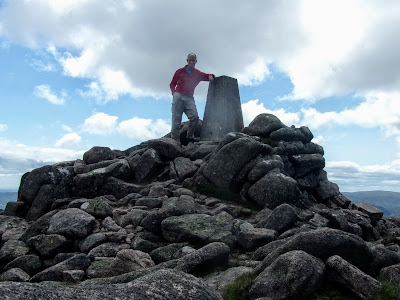
Creag Meagaidh.  Pronounced 'craig meggy' apparently.
Photos to go with this post can be found here.

Friday 24 May 2019

NSW Coast Walk : Review

Freedom!
So, as with some of my previous long walks, I thought that after taking a bit of time to recover I would post some musings on how the thing went.  Well, it was all pretty awesome!  Fair play to the people who came up with the idea for this, it really was nice to do a long trip that did not involve long, long stretches of unimproved forest, or indeed dangerous and absurdly arduous walking through mile after mile of snow.  Perhaps I did sometimes miss mountains, and the succession of beaches did eventually get a little boring, but really this was very cool.  I guess, the fact that Australia was always able to produce some kind of interesting bird or animal to enliven my day meant it was never dull.

They are so cool.
Given this isn't an official trail at all, it really was amazing how little road walking or bushwacking was involved, there was a lot of beach, and other than that a lot of good paths.  None of those paths, individually, were very long - I really do get the impression that this is not a country of hikers - but there were plenty of them.  Obviously there was one serious obstacle - or obstacles - to overcome during this walk, namely the many water crossings.  Getting back from it, I notice that most other people who have done this seem to have mainly crossed the various creeks and inlets on boats, well, I guess I am a bit too mad for that.  But really it was fine, I never felt in any danger, and swimming for fifteen minutes, or even half an hour, isn't too hard - I was happily walking for hours on end after all.  I reckon I swam eight times in all, over the following rivers / etc. :

Wonboyn River
Towamba River
Pambula River
Nelson Creek / Wapengo Lake
Bithry Inlet
Tuross River
Currambene Creek / Huskisson
Crookhaven River / Greenwell Point

So much exciting wildlife.
Many other inlets were closed off by sandbanks so I could simply walk past them, and in one or two cases I detoured around - notably the Tomaga River.  And of course I did take a boat a couple of times, firstly over Sussex Inlet, and then the Comerong Island Ferry.

There was beautiful scenery, mostly coastal of course, but there were beaches, rocky shores, cliffs - all good.  Did I mention the amazing wildlife?  Logistically it was all good too, I had no problem getting the buses to the start, good, cheap food was available every couple of days or so, and Australia's campsites seem to be largely excellent and reasonably priced.  So really, I would totally recommend this walk - just as long as you are happy getting wet from time to time!

Enjoying the view from Sublime Point.
Photos to go with this post can be found here and here.

Friday 5 April 2019

NSW Coast Walk : Bulli to Sydney

KM this section : 58
KM completed : 712

You know where I am?  I'm in the jungle...
Looking to the north from Bulli, I can see that the land slopes steeply up away from sea, there are high cliffs a little way inland in fact.  Sure enough, my route goes that way, to begin with climbing along mountain bike tracks, through what the Australians call rainforest, rather different to the forests I've mostly walked through up 'til now, much of the undergrowth being some kind of palm tree, it feels very exotic.  Then I get to the 'Sublime Point Track', this is crazily steep, a sign warns me that there will be ladders, I assume this is local dialect for steps, but no, a series of metal ladders takes me up a vertical cliff face.  It is hard work with my pack on, but I'm rewarded with a fine view, and then a pleasant and pretty much flat track through more familiar forest.  Eventually I start to descend again, this time a gentle enough grade back down to a beach, and then up again, this time on an unpleasantly busy narrow road for a kilometre or two.  From here, the rest of the walk will be along the 'Royal Coastal Walk', this is a lovely walk, mostly along cliffs, and almost entirely on a walkway with a tough, artificial surface - I think this is the sort of thing the Kiwis I spoke to meant when they talked about Aussie paths all being wheelchair accessible.  I make it to camp at sunset, there is just enough light to cook up the kangaroo burgers I've bought as a celebratory last meal in the wild, who says such a thing cannot be cooked on a camp stove.  They're pretty tasty too...  There are many other campers, it seems to be some kind of christian young men's thing, well, they don't really bother me.

View from Sublime Point.
The christians leave at 4am, all very character building I am sure.  I wait for the rain, which has come down pretty heavily during the night, to stop, and then continue on the Royal Coastal Walk - it seems that the artificial surface is a recently laid new route, sadly they haven't bothered to remove the signs pointing along the old route, this leads to me walking around in a circle.  Then a few more beaches, passing a few points of interest such as wedding cake rock (carefully fenced off to prevent people taking selfies on it, apparently it may fall into the sea at any time), and some examples of aboriginal rock carving.  And that's pretty much it for the planned walking route... though in fact, after a ferry to Cronulla, and a rail replacement bus to Sydney's Central Station, I still find time for hurried tramp around the city - I have to get to the opera house for a photo.  Sydney seems nice, I like the botanic gardens, I should come back here.  Not totally sure about the harbour area where my hotel is, there seem to be lots of loud bars, but I manage to find one more to my taste for one last Aussie burger.

On the Royal Coastal Walk.
Well this was all rather awesome, totally worth the trip, great walking through beautiful countryside, and just so many interesting creatures to gawp at.  I could maybe have done with slightly less swimming, although honestly it worked pretty well, and given that this was not an official route in any way, it's amazing how little trouble I had, only very small amount of hacking through the bush or climbing fences, which to be honest with a little better planning I could probably have avoided.  I may do a more detailed retrospective at some point, with more facts and figures.  And I can certainly see me coming back to Australia, I have only scratched the surface of this huge country for one thing - or indeed, even within the region I was in, there is also a trail leading up the the country's highest mountain which sounds worth a look.

Had to be done.
Photos to go with this post can be found here.

Thursday 4 April 2019

NSW Coast Walk : Kiama to Bulli

KM this section : 60
KM completed : 644

Walking out of Kiama, past the lighthouse.
Unsurprisingly I make it a lazy day in Kiama, it seems a nice place, and there are actually things to see - various buildings dating from victorian times, a large lighthouse, many churches, and I see many signs for the 'blowhole', which I guess will be a sea cave with a partially collapsed roof.  But apart from getting out to do a bit of shopping, I pretty much just hang around the campsite TV room...

Basalt columns.
It really is not far to Sydney now, and not far to walk on my first day out of Kiama, just twenty-seven kilometres in fact.  The Kiama Coast Walk continues, it is still nice, passing some interesting rock formations today, some are natural, some are the results of old quarrying.  There still is a quarry here, my GPS line goes along the road to it in fact, and there look to be many lorries rumbling along it - I find a better route among houses, although for a while I worry that I am in a gated community.  Then back to the sea, good to return to a beach, except, oops, it seems to be being dug up - there is a new marina under construction it seems, there are many danger signs, and on the beach a massive bulldozer is slowly shifting sand about.  Of course, I backtrack and walk around on the road, going through the construction site would be bad and wrong, and I certainly wouldn't want to spend the rest of the afternoon worrying whether somebody there called the police to report me for trespassing...  Well, I make it to camp, at a place named Windang, by 5pm, for the third night in a row I'm at a proper site.  And there is a nearby bowling club where it is schnitzel night - like the Kiwis, the Aussies like their schnitzel, although over here they still generally make it with chicken.

There is a beach somewhere under all that.
I walk out of Windang along a busy road, looks like there's not much land between the sea and the (very large) Lake Illawarra, what isn't this road is houses or a huge golf complex.  I do expect to leave the road after a few kilometres, but, it turns out the GPS line runs along a railway line, not ideal in this country where, unlike America, trains are fairly frequent and go faster than walking pace.  So, I walk along a cycle path instead, which is absolutely fine, for all that it is beside a six lane highway, with a truly enormous steel works between me and the sea.  The afternoon is rather better, I'm still on the cycle path, but it's now a nice route along the coast.  And it is another short day, I reach (another paid) camp for 4:30pm and this evening I find a 'workers club', I must say I approve of Australia's clubs, I have visited a few now and they are generally comfy, and are happy to provide non members like me with food - massive fish and chips tonight - and beer.

Windang Bridge, over the Lake Illawarra inlet.
Photos to go with this post can be found here.

Wednesday 27 March 2019

NSW Coast Walk : Green Island to Kiama

KM this section : 111
KM completed : 584

Él no es marinero / es capitán, es capitán...
I awake to see that Green Island is now properly out to sea, good thing I didn't camp there... Time to walk then, and yes, this means a beach or three - I confess, I am beginning to get a little bored of them.  It is easy walking at least, as far as lunch anyway, I eat beside Sussex Inlet which bars my way north, and seems very wide.  Well, the GPS line follows the bank inland, so I do also, then come to a point at which the line crosses the water, right next to a boat hire place, hmm.  Well, no need for me to swim all of them, so, a bearded nautical type takes me over for a mere ten dollars.  No sooner am I back on dry land, than I spot an echidna making its way across the track ahead, Australia continues to impress with its weird fauna.  From here a long gravel road takes me past the substantial St. George's Basin, and then off back towards the sea, but then the track vanishes, and I am faced with a kilometre or so of insane bushwhacking.  The brush is sometimes chest high, and I worry about what creatures may be lurking in it, other than the massive spiders who I can at least see overhead, sat in their giant webs which I try to duck under.  It is a great relief to rejoin a real path, then not long after I am at my planned campsite - sadly I find it is now just a picnic area, so, off into the woods it is then.

Looking over the Crookhaven, from where I entered the water.
Another day, and of course another beach, and then the longest swim yet, a channel busy with pleasure craft, whale watching boats and so forth.  I wait for a pause in the traffic, then clamber down the piled up boulders into the water, taking a few cuts and scrapes on the way, and then swim.  A strong current is flowing inland, better than out to sea I guess... I'm swept along rather faster than I can swim, but still make steady progress, perpendicular to the current as it were, and indeed as the inlet is curved I return to dry land pretty much where I intended, and only bleeding a little.  More beach walking in my pants ensues, then more water to cross, just a wade this time, and then a nice cycle path.  Leaving yet another beach, my GPS won't turn on, this is not a good time, the wood I'm in is some kind of mosquito hell, still I manage to go the right way and eventually the thing decides to work again.  On to, seriously, yet more water, namely the river Crookhaven.  I follow the line and get to a small jetty, and realise it must at this point be the record of boat trip - no boats about now, I fear...  So, I slog through mangrove swamp to find the best point to cross, the water still looks very wide, but it has to be done.  I set to stripping off and packing up, manage to shed some more blood too, slicing my finger on a shell... Then the swim, this takes a while, the other side just doesn't seem to be getting any nearer, I have to remind myself that this happens with walking too.  There is at least not much current, and eventually I get to the other side, which unexpectedly has a bar, I cannot resist, bring on beer plus pizza, yay.  Then a kilometre or two of night walking, first on road, then a farm track, private land I guess, no help for it, not least I need to find somewhere to camp - a flat bit of grass by some trees will do.

More crazy Australian animals.
Sure enough, I awake in a field, complete with cows, well, got away with it.  The tracks here are up on embankments, I guess this is a drained lagoon, it all feels kind of Dutch.  A short walk and I am looking at yet more water to cross, except this time I can take the Comerong Island ferry, well maybe - the guy in charge tells me sternly that no foot passengers are allowed, but no, this is Aussie humour.  Ha ha.  Comerong Island is very flat, there are more cows, and also horrid flies of the 'really want to land on your head' kind, I am glad to walk off on to a sandbank - seems that currently the island is not, in fact, an island.  Then, shockingly, a beach - a long, long beach, all the way to the small town of Gerroa.  Here my GPS line makes another odd choice, going through a house, heading for a stretch of private land by the looks of it.  I opt for a roadside cycle path instead, them for the rest of the afternoon take the Kiama Coast Walk, a fine cliff path leading to, of course, the historic town of Kiama.  Here I book into a proper campsite, and unsurprisingly head out to find beer plus burger, in a rather odd bar - beer is cheap, but I could do without the youths routing snippets of terrible music from their phones through to some kind of amplifier.

Possible location of pot of gold : Kiama.
Photos to go with this post can be found here.

Tuesday 26 March 2019

NSW Coast Walk : Batehaven to Green Island

KM this section : 100
KM completed : 473

In a proper campsite at Batehaven.
I emerge from my tent, pitched in a not terribly stealthy spot at the edge of a beach, check my GPS, and discover that I am in Batehaven, where I planned to camp, just a hundred metres or so from the Big 4 campsite.  So, I move there, and have a very lazy day, I need the rest - I cannot even be bothered trying to find a bar for dinner, instead I get a pizza and a sixpack of beer, and consume them while reading some of campsite's book collection.

Cephalopod art by Batemans Bay.
Feeling better for a rest, I head out on to the beach the following morning, of course there is a small creek to wade.  Then road for a few kilometres to Batemans Bay, where I do a bit of shopping, including much needed new socks, hopefully my feet will like them - they are a little sore thanks to the constant presence of sand in my shoes.  I walk a along a bit of the busy Prince's Highway, not much fun, and then of course more beach, plus some mostly pleasant forest tracks.  There's a section where the GPS line suggests traversing a rocky slope above the waves, I take a path instead, and then my map shows a big river to cross, but I'm glad to see it is dry despite the recent rain.  Buoyed somewhat by this, I follow the line around one headland rather than taking the obvious trail, this involves much bouldering, then a walk on wet rocks beneath a cliff, if the tide was in just a bit more would not be possible, and as it is I worry about getting cut off by the rising water.

Glad I didn't try this at high tide.
After a night on a pleasant grassy spot by the sea, I walk a little then pop into a private campsite to obtain water and use their facilities.  Perhaps this earns me some bad karma, as while I am in the 'dunny', a bird steals the crackers I was going to have with some cheese for lunch...  Oops.  Ah well, it is at least a nice morning of walking on the Durras Mountain Trail, good to climb a hill - the 'mountain' being fully two hundred and seventy-seven metres above sea level.   I return to the coast, passing through a picnic area where Paul and Greg, a couple of friendly locals, provide me with tea and cake - as near to trail magic as I will get here.  I find a small store, where replacement crackers set me back four dollars fifty, ouch - they do come with some kind of cheesy spread, but it is so horrid that I bin it.  Then back to walking the beaches and headlands, I cross another dry inlet, and then another rocky ledge to get around, this time actual mountaineering is needed.

Think I can probably manage to wade this one.
The next morning there are, amazingly, more beaches, well it is easy enough going, to Ulladulla for lunch - I seem to be doing OK for money, so I find a bar for beer and burger.  Time for a bit of shopping too, this being my first town for a couple of days.  And still there are more beaches, then some excitement, a wide inlet to cross, much is just a paddle, I wish I hadn't wrapped up the camera as armies of dainty blue crabs scuttle about.  Then a deep channel, which I just about manage to wade, on a winding and tricky to see line of sand.  Lightning flashes nearby, and it starts to chuck it down as I walk one more beach, well at least all my stuff is wrapped up in the drybag.  The rain clears, a rainbow appearing as I reach Green Island, a little wooded spur of land, currently I can walk onto it and consider camping, but I don't want to get cut off by the tide - easy enough to find a spot by the beach anyway.

Photos to go with this post can be found here.

NSW Coast Walk : Victoria Creek to Batehaven

KM this section : 99
KM completed : 373

Walking doesn't get much easier than this.
Time for some serious walking, I make an 8am start, and as it turns out Victoria Creek is just a waist high wade.  Then there's more beaches, more headland, and another small town for lunch, Narooma.  My route takes me along a cycle route for six kilometres or so to Dalmeny, then it is yet more beach.  There is still lots of interesting wildlife, I see parrots in the trees, and out to sea there are mammals of some kind playing in the surf.  No, not the gnarly surfer dudes, though there are plenty of them, but rather I think whales of some kind.  And on the beach, I walk beside big, birdlike tracks, maybe an emu?  But it is a long day, my feet are feeling it, though I do at least make up the distance to get back on plan.

Bingie Bingie Point.  So good they named it twice...
I am still going, next morning I have another big swim, a strong current tries to drag me out to sea but I manage to resist it.  From here it is a nice walk to Bingie Bingie point, then there is a Bingie trail too, it makes a nice change from the beach.  And then further inland, to avoid a big estuary it seems, good to see a bit of the interior, there is much grass with cows grazing, it feels very English, barring the Aussie style buildings - squat and square built, with verandas and gently sloping roofs.  The weather seems kind of English too, it rains on and off, not cold though.  I reach my planned (private) campsite at 5:30pm but nobody is there, so I decide to camp in a small park across the road instead, but first, to a nearby bar for burger plus beer.

Makes a nice change from beaches.
A bit of road walking takes me back to coast, then some dirt tracks, easy enough.  I don't fancy swimming the Tomaga river, so detour around on the road, this means delay of course, I don't need it on what is a long day already.  Things get worse after lunch, there are many little beaches, with a slog up and over the headland between each of them.  Then I follow my GPS line over a rocky beach to find myself facing a cliff, maybe the people who made the line were here at low tide and it was possible to walk along the base of the cliff, but I have to backtrack and take the road, in fact it is a long road walk now.  Doesn't look like I will make my planned camp, and as it gets later I worry about finding some food before everything shuts at 8pm - as seems the norm in this country.  The road has plenty of houses, but no shops, restaurants or whatever, I keep walking, and finally reach some sort of place at around 7:30pm.  There's no bar, but I get a couple of cans of beer from a drive-through 'bottle shop', and a hearty plate of shrimp fried rice.  Everything does indeed shut at eight.

The insurmountable cliffs.
Photos to go with this post can be found here.