Wednesday, 29 January 2025

Lesser Patagonian Trail : Palena to Trevelin

Kilometres this section : 104
Kilometres completed : 1,928

I opt to not take a day off in Palena, despite the hard work over the last few days. It's not much of a place, and in three days time I should be in Trevelin, a substantial town. Easy enough to get there too, only 100km or so, almost all on roads, starting with 10km of gentle climb on route 235. This leads to a potential obstacle - I need to cross back into Argentina here, at Paso Río Encuentro, and I am looking a little worse for wear after two months of walking. Will the border guards approve of this apparent vagrant wanting to cross, I wonder? In the event it's not a problem, the guards on both sides are friendly, and the crossing doesn't take long. Even better, as I hoped the village just into Argentina, Carrenleufú, has a panadería where I buy many baked products for lunch. More easy walking, the road is now gravel, after fresh tarmac on the Chilean side, the surroundings green, wooded hills. A bridge over Río Corcovado, locals are picnicking and swimming, I collect some water and head north on a more minor road, route A30 - back to gravel, it's more authentic I suppose. Just a little way to my planned stop, with 35km done, quite a few buildings around here but I find a sheltered spot in the woods. Then as I'm putting up the tent, a couple of dogs turn up, oops - I must be pretty near someone's home. Fortunately they just look at me briefly then depart, rather than furiously barking. Given it has just started to rain, I really didn't need somebody coming to tell me I can't camp here!

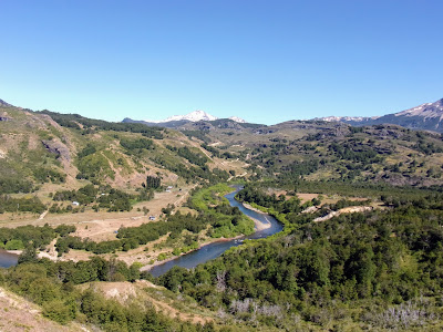
I survive the night undetected, and walk off, quickly reaching a small village, Cerro Centinela, no sign of any stores here, although it does see the road surface change to tarmac, so easy. I join provincial route 17 and walk past Laguna Theobald, with a fine view to the snowy mountains that mark the border. Then a road so minor it has no number, and is no more than a dirt track - maybe private, though there was no sign. Well, easy enough, a gentle ascent, I am making good time. I did want to give myself some leeway today, the last few km will be the start of a short section that is not a road - will it be a barely detectable path? In fact, after a few km of vehicle track I do get a bit of horse trail, but it's in good condition and flat enough. Actually the only problem is the Patagonian flora, which often tends to have annoying spiky seeds, they're particularly bad here. Still I have no trouble doing 40km, only 29 left to Trevelin. Oh, and interesting animal life makes a return, I think a skunk? Sure was a friendly little critter anyway.

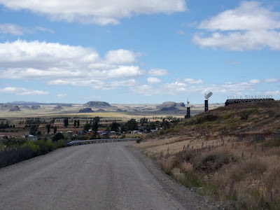
Just a little more horse trail, then a gravel track, and I am on a public road again, Ruta Nacional 259 even - still a gravel track, but there's a fair bit of traffic, going very slowly. Good to get off it, minor roads and even a bit more trail, and I am in Trevelin by 3pm. Not quite as big as I imagined, but I have an actual apartment booked, and there are restaurants here with menus and beer on tap, oh yes. I enjoy a large pizza and a glass or two, surprisingly enough. Interesting place this, mostly settled by Welsh people back in the day, a sign near my apartment informs me that the first store in town was built there, opened by Señor Robert Bobbie Williams. There are even bilingual signs in Spanish and Welsh! More importantly for me there's a decent supermarket, I acquire yet more socks, and new trekking poles. An even more momentous purchase is a new pair of shoes, obviously I started in a pair from Decathlon which have lasted nearly 2,000km, hopefully the new ones will survive some decent fraction of that.


Tuesday, 28 January 2025

Lesser Patagonian Trail : Lago Verde to Palena

Kilometres this section : 96
Kilometres completed : 1,824

I make a late start from Lago Verde, the hospedaje is indeed hospitable and it is hard to leave, well the walking goes easily enough for the first 20km or so, on the usual gravel track. Then a horse trail, with actual cowboys, one driving a bunch of cows, and some more going the same way as me, I see them a few times. It's hard to find the way now, makes for slow going, and then a thigh deep ford, OK I can do that. The path returns to this river, so it should be flat, right? Haha, no it's a brutal slog up, to 900m or so, and worse, there are so many deadfall trees, I either clamber over or detour around. Clearly at one time there was a trail here, massive sawn logs, and even occasionally a post marking so many kilometres, bear witness to the work of the ancients who laid it out, but now little of their work survives, it takes over four hours to do 8km, but I need to get back to that river for water and somewhere flat to camp, just have to keep going - it is past 9pm when I get there.

Second day of this section, the path is a bit better, flatter, with fewer deadfalls, this is actually nice walking through the forest. Still slow going though, I have to face it, I'm not making this section in three days as I'd hoped, but no matter, I've actually planned for this and have enough food for four days. So, after yesterday's heroics, I only need to do 20km today, how hard can it be? Well, there is lots more water, I walk beside a lake, mostly in the lake as it turns out, and also in a freezing river for a while. The worst bit is late in the day, my map has the trail as a dead straight line, but of course that is not the reality. So, when I lose the trail, I have no way to find it again, no choice but to struggle through the dense woods as best I can for several km, this is such hard work. All the while a light rain is falling, no problem in itself, but of course the plants I am pushing through are wet, soon my trousers are soaked. At least, I find a nice grassy spot to camp at, and I did the 20km.

Another day, and I am looking to do 20km again, but, a there's a problem with not following a path - I basically walked a straight line last night, I know where I need to be, at one end of Lago Palena, so I headed towards that point. It turns out I am way above it, the descent without a path is very slow, and the path is little better when I finally reach it, there's no sign anybody ever comes here. I struggle on, walking in the lake for a bit, checking my watch the first 6km today has taken over 4 hours, at this rate I will need another day, and one with no food at that. But, the path up from the lake is better, sure it's super steep but it seems used. Even better, it takes me above the tree line, to some lovely mountain walking, oh wow there are no deadfalls here! Of course now it's down again, but the path is still good, though I lose it for a while, and walk along Río Azul instead, this includes much wading, nonetheless I manage 18km, and Palena is now only 27km away.

So, I was assuming that the remaining 9km or so of trail would be just as hard as what I've done over the last two days - not so much, it turns out. Before very long I'm walking along a track used by vehicles, oh so easy, and then it turns out I got the distance to Palena wrong, it is two kilometres less than I thought, oh no. I enjoy a few hours of easy enough walking, and reach Palena before 4pm, this is good, I have time to find a hostal and do shopping, including desperately needed new socks. This week I learned - if the sole of your sock is full of holes, you can still get some use from it by wearing the thing back to front!


Wednesday, 22 January 2025

Lesser Patagonian Trail : Villa Amengual to Lago Verde

Kilometres this section : 125
Kilometres completed : 1,728

After doing 40km or more each day for a while, I am taking it easy for a bit, more like 35 or even less.  So a late start from Villa Amengual, on yet another gravel surfaced minor road, the X25.  It follows Río Cisnes upstream, so yes I have to climb, but it is mostly gentle enough, the river running through a steep sided, tree lined valley with the road some way up one side.  Not the most exciting walk, the most notable moment is when I am stopped for lunch and realise that large numbers of little red beetles are crawling over my stuff, and indeed me.  They seem harmless enough, looking a lot like my favourite bugs, ladybirds - these things seem unable to fly though.  Today I had planned to camp by the river, but it becomes clear that isn't happening, even when I am only a hundred metres or so from it the water is still a long way down.  Well, I get water from a little stream instead, and find a lovely grassy spot for the tent.  A large fox watches me set it up, the animal doesn't seem at all concerned by my presence - it is not getting any of my food though!  And yes, I do find numerous beetles have hitched a ride in my pack.

On a lovely sunny day, I continue to climb on the X25, the banks of the river growing less steep and the surroundings looking increasingly dry.  To yet another village, La Tapera, more bonus biscuits for me.  And for the first time in several days, I leave the public roads behind.  Obviously this means I immediately have to ford the Cisnes, well it is broad but only calf deep.  And yes, the dirt track I am on climbs steeply up to over 1,000m, and even the horseflies - tábanos they're called - are back.  For all this it's good to be back in the wild, and there is a nice view from the hill.  Of course, from there I descend again, to a lovely camp spot by a pond fed by a little waterfall.

Another river to ford, Río Cáceres - I don't see any other water on my map until maybe the end of the day, so take the opportunity to fill my bottles.  Then glorious walking, I climb slowly through terrain that is sometimes pretty arid looking, at others green with trees.  I'm making my way up to a pass, snowy mountains on one side, to the other the bare, and extremely pointy, Cerro de los Contrabandistas.  As with the Ruta de los Pioneros a few weeks back, I often pass little parches of pasture, and indeed, on reaching the pass, some 1'240m above sea level, it is an open, grassy place, complete with cows grazing.  A couple of cowboys - well, cowgirl in one case - even turn up, presumably to check on the animals, I explain where I am going and I think they are OK with it.  Honestly, I often have no idea what the people out in the countryside here are saying.  Anyway, down - very steeply from the pass, and obviously I am following a river, as I have for most of the day, including multiple fords.  There were even substantial lakes...

I've failed a bit when it comes to only averaging 35km per day, my camp next to a river is only 20km or so from the village of Lago Verde, end of this section.  Well, good to take it easy - relatively, there's some steep climbing, still on a vehicle track, then onto a horse trail which descends precipitously, I am glad of my poles.  Stopping for a break, I notice little red berries down at ground level - wild strawberries!  Apparently this species is one of two that were hybridised to create the commonly eaten variety - the original is tasty, but small.  Anyway, not far to Lago Verde, and wow, not much of a place, I am worried I won't find anywhere to stay, but no, near the pioneer monument there's an hospedaje, 25 whole dollars here.  Mind you that is with full board - yes this involves much potato, although dinner on the second night is a bit of a change, stir fried chicken with rice - plenty of carbs either way.


Thursday, 16 January 2025

Lesser Patagonian Trail : Coyhaique to Villa Amengual

Kilometres this section : 161
Kilometres completed : 1,603

I am not feeling terribly enthusiastic about the next few days, as the only route I could find north from Coyhaique involves lots of road walking, much of it along the Carretera Austral highway. Had I managed to walk the trail through Cerro Castillo, this would have been a nice change and a bit of a rest, as it is I just walked on roads for three days, it could get a little boring. But in fact, a few km out of town the traffic heads off towards Puerto Aysén on route 240, and the Carretera Austral becomes another gravel track, pleasant walking through very green country, grassy meadows with abundant wild flowers, woods, with of course towering hills all around. I think it must rain reasonably often here, in fact I get a few showers, on what is a very windy day - fortunately my route is mainly sheltered from it. After lunch I turn off the 'highway' onto route X555, no traffic at all here, and the sun comes out, all good. A nice camp spot to finish too, plenty of grass growing in the woods here.

More gravel road - the X45 now, through hilly, wooded country, up to a pass then down along a river valley. Seems to be quite populous around here, lots of little homesteads, and villages too, Villa Ortega yesterday, and now I am approaching the implausibly named Ñirehuao. As I decend towards the place, there's a really rather awesome view beyond it to the east, a broad, barren looking plain, with many rocky promontories sticking out of it. Maybe the tops of ancient mountains, almost drowned by the land that has somehow risen among them. It is a bit disappointing to turn back west, impressive enough though the actual snowy mountain that way is. And again, to camp, a nice spot by a river tonight.

A little way north the next morning, and another little settlement, El Gato. Not much more than a single farm here, but it does have a school, and even a shop - I get some extra biscuits, why not. From here, the road climbs steeply, this is rocky country, sheer cliff faces all around. Then down and past a substantial mine, with its own little collection of houses for the workers. Not sure what is being mined, but it looks like people have been digging for a while in these parts, I follow a river through a gorge, and on the far bank there are several dark tunnels leading into the rock. It's a wet and windy day, the rain not heavy, but less than pleasant when the wind is driving it at me, thankfully that isn't too often. And, another day of easy walking done, camping by the substantial Río Mañihuales tonight.

The last day of this section is a return to the Carretera Austral, still only a single carriageway with not much traffic, but a modern tarmac surface. As usual I wonder why most hikers apparently hate this kind of walking, for me it makes a nice change, Indeed I can really power along. So good to be able to walk with my whole foot, touch down on the heel, roll forward, push off with the toes, and at no point is there any chance of skidding on a loose stone. A lovely walk too, sheer rock faces, tall mountains and rushing rivers. It's another cloudy, damp day, though the rain is never heavy and the sun comes out often enough. Still, very green here, and wow, quite a lot of bamboo growing in these parts. And, so easy this, I finish before 5pm, hmm, Villa Amengual really is not big, I walk around the whole place, not seeing a restaurant, or an open shop... wait, here's a place with a sign saying 'supermercado'? Well, it is a minimarket at best, but, they also have rooms - 15 dollars a night! And indeed dinner, which involves much potato, and given the minimarket is right there, I get beer at shop prices. I should move in to this place!


Saturday, 11 January 2025

Lesser Patagonian Trail : Puerto Ingeniero Ibáñez to Coyhaique

Kilometres this section : 150
Kilometres completed : 1,443

After finding the last eight days or so of walking very hard work indeed, I decide to take things a bit easier, from Puerto Ingeniero Ibáñez it is around 40km to another small town, Villa Cerro Castillo, and I am doing it in two days.  So, I don't even start until 11:30, walking north on provincial road X735.  As is often the way, the road is a lovely walk, following Río Ibáñez but without any need for steep up and down.  I stop for lunch by the astonishing Salto del Río Ibáñez, vast quantities of water gushing down the rocky hillside.  Then a gentle enough climb, onto route X723 which runs alongside Río Claro in a dramatic gorge.  Then up to a pass, the road levels off despite the rocky cliffs rising on all sides, and an early camp, not even 6pm yet.  I am so lazy.  I don't work much harder the next day of course, a little more road, then one of the best footpaths I've encountered here, passing between Lago Central and Lago Tamango, before climbing into glorious natural parkland, pine trees and grassy clearings, with a view north to the towering mountains I'll be walking through next.  The route is regularly marked by poles with red and white stripes, and the gates even have steps for walkers!  By mid-afternoon I am in Villa Cerro Castillo, another lovely campsite, and a fine dinner, a massive salmon fillet with 'mil hojas de papas' - basically pommes dauphinoise.

Right, into the mountains then, this route is supposed to be pretty special, through the Cerro Castillo national park.  Six kilometres out of town to the trailhead, I am expecting to have to pay to get in, but in fact it's much worse, the official simply won't accept my plan to walk north.  Apparently there is a rule, you see, this route can only be walked the other way - from here it would be difficult, and steeply uphill.  The horror!  Well, no help for it, I retrace my steps, then head up the Carretera Austral.  It certainly is a very scenic road, climbing via a series of switchbacks to a viewpoint looking back over Río Ibáñez.  From here, easy walking up to a high point, between dramatic walls of rock, and a gentle descent alongside a river.  Eventually I reach Las Horquetas, the other end of the oh so difficult trail - recommended pace for it is four days, I gather, although my route involved veering off north before here.  Well, an easy enough day at least, and I find a sneaky spot to camp by the river without difficulty.

I think I am only 60km or so from Coyhaique, along the Carretera Austral - it is annoying not to be on my planned route, which has waypoints every 5km so I always know the distance pretty well.  So anyway, my thinking is, rather than walk the highway all the way there, I can detour onto minor roads, avoid the traffic, and even get back to my route this afternoon.  Well, the first detour, on route X678, works well, it is indeed traffic free, barring a couple of friendly Carabineros.  Lovely countryside here too, seems more agricultural than what I have seen prior to now, lots of cows and mown fields with bales of fresh hay.  Back to the highway, wow, lots of cars now, I can't wait to get off it, onto route X674 now.  Again charming, through green Valle Simpson, with mountains ahead.  But when, getting into late afternoon, I see a sign reading, 'Villa Frei 20km' I am not best pleased, this means I am still nearly 60km from Coyhaique.  Nothing for it but a forced march until 8pm or so before camping.  From Villa Frei I take route X648, there are signs telling me I am on the Sendero de Chile, well nice to be on a named trail, and indeed it is a pretty route, winding past numerous lakes.  I can see why this way is so much longer than the highway, the road snakes back and forth, but it's pretty flat and I make good time.  I could really do without the resurfacing work on the last 10km past the airport though.  But I make it before 6pm, time enough to check in to a hostal, and have a shower before heading out for beer and yes, a giant burger.  Coyhaique - a fun name for non-native speakers of Spanish to say - is the provincial capital, big enough to have supermarkets and a variety of restaurants.  Still not the most impressive place, but good enough for me.

Incidentally, keen readers (ha) may notice that I have changed the name of this little adventure.  It turns out that Mr. Dudeck, who came up with the name 'Greater Patagonian Trail', feels a... strong sense of ownership of the name, and the idea of a collection of routes with that name.  Out of respect for that, and given that I am walking my own route which only sometimes follows his, I am changing the name.  At time of writing, posts prior to this one still use the GPT name, but I will go back and edit them at some point, adding a note to the first post.


Monday, 6 January 2025

Greater Patagonian Trail : Cochrane to Puerto Ingeniero Ibáñez

Kilometres this section : 154
Kilometres completed : 1,293

A few km of road takes me out of Cochrane, and to the entrance of Parque Nacional Tamango, I am expecting to pay a fee to get in, but the office is empty, it is New Year's Day I suppose.  There are various trails running through the park and I head off along one, Los Carpinteros, it runs alongside Rio Cochrane, then another trail, Los Coigues, skirts the western end of the huge Lago Cochrane.  Of course this means a series of near vertical ascents and descents, but here it is a lovely walk, these tracks are well maintained, there are wooden stairs and bridges, and someone has even cut back the grass!  The views over the lake to forested hills and snowy mountains are simply majestic, and I even see a huemul, a member of an endangered species of deer native to the region.  Only problem, it is slow going, I worry about getting to the next town in the four days I've planned, which would be annoying as I have a hotel booked.  So, on leaving the well maintained trails, I really need the next bit to be walkable.  Thankfully I get a well used path, even flat for a bit, then a steep climb on a track clearly used by vehicles, good enough, and from the high point, easy walking through lovely green valleys.  Still I only make 33km before camping, I will need to do better tomorrow.

My second day of the section starts with an easy, pleasant 20km on road X83, into Parque Nacional Patagonia.  Then onto Sendero Valle Avilés, following the river Avilés upstream, but this is not so bad, almost all up over many km, and not much down so the ascent is gentle enough, I make a decent pace.  The route has me wading the river just before I plan to camp, I hope it is OK, but in fact I hit a nasty crossing of a creek a few km earlier.  It's only a couple of metres across, but the middle is waist deep and the current is so strong, I can't get stable enough to take another step, I try and over I go, and end up floundering to the other side somehow.  A good thing it is a warm day, no harm done, and I cross the river itself easily enough.  I walk a couple more km to dry off, making for a rather better 41km today.  Lots of fords on the route for tomorrow, hopefully nothing that bad again.

As it turns out, the fords are OK, but there are so many of them.  It's a long walk down Valle Hermoso, it is indeed pretty, a broad gravel bed with a braided river threading through it, easy enough but with repeated crossings, I keep having to stop to empty stones out of my shoes.  Also the wretched insects are back, I think the spray helps a bit.  To Lago Verde, more blue than green, and of course, staying close to a lake means a brutal slog up to Portezuelo La Gloria, and it's just as steep going down, then it's time for more gravel and repeated wading.  It is very nice to reach Laguna Jeinimeni, which has an actual flat dirt road along the bank.  This leads to a popular campsite with various wooden shelters, and unbelievable numbers of caterpillars, I can't stop here though.  There's still 10 more km along a minor road, and I camp at 8 again.  But now, only 44km remain before that hotel room in Chile Chico.

It's so good to walk a gravel surfaced minor road, no need to wade raging rivers or watch every step lest I trip.  I can walk and enjoy the stupendous mountain scenery, and pause by Laguna Los Flamencos, where there are indeed flamingos.  The road follows Rio Jeinimeni, which is also the border with Argentina - I think I could wade it but probably best not.  All told, a lovely walk this, people even give me things, water from one nice lady, then a car stops, three locals I met yesterday, plus German Sophia who I walked with for a while, they give me almonds!  Only a shame it is so long, honestly I screwed up here, should have taken five days for this.  Well, a forced march gets me to Chile Chico, there is beer, and carne mechada, served like a hotdog, then because I am still hungry, on top of chips.  All good.  Indeed Chile Chico is a lovely place, on the shore of Lago General Carrera, Chile's largest lake, a great place for a rest.  I paddle in the chilly water, climb up to the Mirador de las Banderas, but mostly just relax.  Then, a vehicle journey!  A decent sized ferry takes me across the lake, to Puerto Ingeniero Ibáñez - nice to see a town named for an engineer.  It is not the biggest place in the world, but the cabaña I have booked is lovely, and the site has what seems to be the only open restaurant in this tiny town.  They provide me with an enormous grilled trout fillet, oh yes.