 |
| At the resort in Takhli. |
I ride south from Nakhon Sawan, through pretty mountainous country, but the route I've planned manages to be flat enough. I do pick up a puncture, it is only a slow though so I opt for pumping up the tire whenever I stop to take on water, which is often of course. Not a terribly long day, only 70km or so, I reach my destination, Takhli, early enough. Time to fix that puncture, and a good thing it was only a slow as I struggle to remove the wheel, it is a quick release of course but I can't budge the lever, looking around the (charming) resort I find a piece of metal rebar which lets me apply some extra leverage, sorted. More difficulties though, riding off to a bar I arrive to find it shut, and then rain starts to pour down, no choice but to wait around for half an hour. Then the second bar I try is shut too, these are all several km apart on a busy road, good thing I am on the bike. Well, the third bar is thankfully open, it also provides me with a fantastic fish curry.
Day six of the trip, another 70km or so, today I follow a railway line for a while, then a nice road along a substantial canal, built for irrigation purposes I guess. Only problem is that as this isn't a natural watercourse, it doesn't really pass through any towns making it hard to find water, in the end I have to detour away. I enter yet another province, Lopburi, and follow the canal to my destination, the provincial capital which is of course also named Lopburi. Again it is a bit hard to find a bar, the route google suggests I take to one involves a road that doesn't exist in reality, so I have to backtrack along a road with many barking dogs. Then it turns out the bar doesn't exist either, a victim of Covid I imagine, well, I eventually find a place where I am, of course, the only customer.
 |
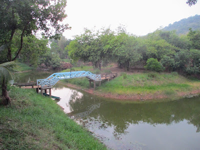
| Pasak Chonlasit reservoir. |
A long day from Lopburi, I am now heading east back towards home, but at least for most of the morning I'm going downhill and make good time, the low point being the impressive Pasak Chonlasit reservoir. I did plan to ride along the dam, but the road is closed, well the minor road below the dam is very pleasant. From here, the cycling remains flat for a while, then mid afternoon I am a bit disconcerted to see a sign saying it is still 69km to my destination, Pak Chong. Fortunately it seems that was for a route staying on major roads, well, the route I've planned is only 25km and actually the roads are fine, if rather hilly now, I do have to push the bike a bit. Seems this is popular cycling country, I see a few others about on my way into town. Pak Chong is a very popular tourist destination, close to Khao Yai national park, so no problem finding a familiar bar with a proper band playing.
 |
| Lovely mountain scenery in Khao Yai. |
Last day, good thing too, I feel a bit broken. Not sure about the handlebar grip design on this bike, both of my hands have gone kind of numb, also I have a few patches of sunburn, well it will heal. The day is a hard one of course, 90km or so and I am going through that national park - the only alternative being to ride on what is essentially a motorway back to Sikhio. Well, it certainly makes for very pretty riding, and in fact for much of the morning I am going downhill, southeast rather than directly east towards home. I can however see a line of steep hills to my left, at some point my route will turn and cross them, well, hopefully there really is a road there. In the event, yes, there is a very, very steep road - at times I can barely push the bike uphill, let alone pedal. There is at least a nice view on the way up, and when I finally reach the top, some fun freewheeling down the other side. Not too far now, more pleasant countryside, including another reservoir, Sap Bradu, on my way back to Sikhio. And that is that, well, all good fun of course, and I am sure feeling will return to my little fingers at some point. I shall have to see about a route to the south or east of here at some point.
Photos to go with this post can be found here.


