Monday 16 October 2017

Pacific Crest Trail : Stehekin to Manning Park

Miles this section : 81
Miles completed : 2650

Many fish in the Stehekin.
Stehekin isn't actually on the trail, indeed it is fully eleven miles away along a little used road, which actually has a regular bus service, I guess intended for the use of tourists arriving in town via the passenger ferry, and as you'd expect popular with hikers.  But I have got this far on my own two feet, I'm not going to get into a vehicle now, so eleven miles of walking it is.  In fact I rather enjoy the road walk, even with the resurfacing work that is going on...  It runs through a deep gorge alongside the fish filled Stehekin River, the riverside makes a nice place to stop for lunch, and I guess those fish are attracting predators, as while I'm eating a Bald Eagle flies directly overhead!

Some fine walking in this last section.
I get back onto the trail, thankfully the weather has turned dry again, quite sunny in fact, which isn't without potential issues - I nearly step on a rattlesnake sunning itself on the path at one point, did not expect them so far north.  I reach the campsite that the rangers gave me a permit for, this is in a national park, hence all the regulations I guess.  They really didn't want to give me a permit for this site, no idea why as it is empty, at least until some more hikers join me - they have a permit for a different site, but somehow the world does not end.  I look at the wire from which I'm supposed to hang my food, I think if I spent ages removing all the guy ropes from my tent, tying them together etc. I might produce something that would maybe result in a hungry and frustrated bear lurking around the campsite.  I don't bother, but of course now I worry about rangers for much of the night.

Well, in the event I am troubled by neither rangers nor bears, but after a less than great night's sleep I have a long climb to do, up to seven thousand feet, although it's an easy enough grade so I make steady progress.  There are some last mountain passes to go through, with proper wilderness names such as Cutthroat, Granite and Glacier, they are most scenic, kind of cold camping up among them mind you - I imagine it is getting cold for the wildlife too, as at one point as I'm getting to sleep I hear some sort of critter running around between my tent inner and flysheet.

A brief escape from the clouds on the last day.
Some excitement to liven up the last few miles, a couple of hikers just ahead of me have found a gun on trail!  It's loaded with birdshot, though there are other types of ammo, plus the owner's bag and phone nearby - they carry it off to the nearest road hoping to find somebody to give it to.  I'm into the last fifty miles now, walking under blue skies to Harts Pass, where the trail crosses the last road before Canada - I did plan to camp here, but there is no water and they want eight dollars!  And yes, there is some kind of ranger / guard present to enforce this, and presumably keep a watch out for invading Canadians.

Woohoo!
One last day or so and I reach the end of the trail, something of an anticlimax of course, the country on the other side of the border looks much the same, though there is a strip of cut forest running off up the hills to either side, and a couple of monuments.  I'd hoped for a moment of quiet contemplation here, but of course there is a steady stream of hikers turning up, and enjoying celebratory drinks or indeed other substances.  Well, still another nine miles to go until I can rest, but it doesn't take long, and on reaching the road the small resort of Manning Park has all I need - yes, there is burger, beer, and somewhere to sit while I wait for the (2am!) bus to Vancouver.  Oh thank goodness, it is over at last.

Photos to go with this post can be found here.

Thursday 12 October 2017

Pacific Crest Trail : Indian Pass to Stehekin

Miles this section : 74
Miles completed : 2569

A cold morning after a snowy night, by Mica Lake.
Indian Pass isn't any kind of rest or resupply stop, just a random gap in the hills, but it seemed like a good place to end the last entry - obviously, not the smartest place to camp though.  Believe it or not, I am now not in a particularly good mood, really not feeling the whole trail thing, but still there are one hundred and eighty miles to go, I had best get on with it, not least while walking to Canada may be hard work, it is considerably simpler than trying to figure out an alternative in this misbegotten country with its near-total lack of public transport.

Not the best weather, though a rainbow is some consolation.
Of course, now I've been penalised for potentially starting a wildfire in this 'tinder dry' country, it is raining, a grey drizzle that matches my mood pretty well.  This turns to snow higher up, not too heavy and indeed it doesn't get me wet the way the rain does, but I guess it keeps going all night, given that I wake up to find my tent covered by snow.  It makes for a cold early morning walk, but oddly this cheers me up a bit - maybe it's a reminder of cold, damp walking back home, or maybe is because I can cope with this, whereas others are clearly struggling.

It rains on and off for days, each day my kit gets a little damper from the water I unavoidably bring into the tent, and it becomes harder and harder to stay warm at night.  There is at least dramatic mountain scenery to enjoy, and the pine forests are pretty too with the snow decorating the trees. The trail grows muddy beneath my feet, but there's not enough snow to obscure it - yet...

The beautiful Stehekin Valley.
Well, I make it to the small tourist town of Stehekin, a charming place by Lake Chelan, indeed only accessible by a ferry over the lake, or of course by walking.  Time for my last zero day, it's nice that there is free camping, although I find it hard to be patient with the necessary form filling (one for each day!) and the patronising rangers - I need a permit for my planned campsite a few miles along the trail too, this comes with instructions as to how I absolutely must camp in the right place, and also hang my food from a tree because of bears.  Apart from camping, everything here is pretty expensive, but I do manage to get some beer, a burger and some impressive pastries.  My last package is here, I sent this one using the 'retail ground' option which was at least slightly cheaper than 'priority mail', that may have been a mistake as it seems to have been used as football, my cookies are in bits and there is couscous everywhere... ah well, the hiker box comes to the rescue.

Looking across Lake Chelan from Stehekin Landing.
Photos to go with this post can be found here.

Thursday 5 October 2017

Pacific Crest Trail : Snoqualmie Pass to Indian Pass

Miles this section : 104
Miles completed : 2495

Dramatic Washington.
There's a long section coming up now, I leave Snoqualmie Pass after lunch, with the aim of doing fifteen miles before camping, after that I'm looking at seven full days, averaging twenty-five miles per day.  It's immediately clear that this is going to be hard, the trail consists of one gruelling slope after another, though it is worth it to walk through stunning surroundings, with views of peaceful lakes and steep sided mountains, and slopes covered by heather and bracken between the pines.  But it is slow going, I just about keep to the plan, but on each of the first two nights out I don't reach camp until around 8pm - which is well after sunset now, there's just about enough light to put up the tent.

Spectacle Lake.
I decide to take an extra day getting to the next resupply stop, there's no sense spoiling this beautiful section rushing it and I am not really pressed for time - I guess at some point the weather is going to turn, but even if it does, one more day of cold and damp won't be the end of the world.  This does mean I need a little bit more food, but that's OK, next day the trail goes through Stevens Pass, yet another small ski resort - I certainly wouldn't be able to resupply here, but I get a decent lunch from their snack bar, that and some candy, plus hiker box pickings is good for one day of food.  They also have wifi, just about, I check my email, and wonder of wonders I have my Canada permit.  A good thing too, latest news is that the road I'd have needed hitch along towards Seattle, as an alternative to walking into Canada, is shut due to fire.

Heading up to a high pass.
The going seems easier after Stevens pass, and it is nice to no longer have such long miles to do, I can take decent breaks, and if I want to stop for ten minutes to pick some huckleberries there is nothing to stop me.  It is still pretty smoky, I can see the nearby peaks but the view is hazy, but I must be getting away from the fires now surely - it is certainly getting quite cold, skies are cloudy, but still the rain holds off.  I'm not doing nearly such long days now, in fact on the second day after Stevens Pass I make camp at 6:30pm, time to make fire of my own - this turns out to be a bad idea, a fat guy in sandals turns up and says there is a state wide fire ban, well OK, I will put it out - he then says he is going to give me a ticket and I realise he is a ranger, the ticket is for $230!  Really not what I need with the budget already stretched, well, screw him, screw the US forest service, and indeed screw this dystopian country.  For sure, I've had a lot of good times here, but there are also plenty of things I am now heartily sick of - the often dubious food, the towns built for cars rather than people, and most of all the way I just can't get away from people in uniforms telling me what to do, even out here in the supposed wilderness.  Land of the free my ass, as they say here.

Stevens Pass ski resort.

Photos to go with this post can be found here.

Tuesday 3 October 2017

Pacific Crest Trail : White Pass to Snoqualmie Pass

Miles this section : 99
Miles completed : 2391

Leaving the trail at the Highway 410 crossing.
White Pass is little more than a gas station, there is a small ski resort, but only the hotel is open - I do need a rest though, I ask about a room, they want $120... OK, I plan to camp nearby in the woods, but then my trail buddy Paul turns up, he has booked a room, he needs the comfort as he has broken two bones in his foot!  He says I can have a bunk bed in his room, I have no cash to give him but I buy him some beer and pay his box holding fee which seems fair - the bunk is pretty small, nice to have a bed though.  My Walmart stuff is here, this is good, there is a lot of food which should get me to the next stop, and indeed cookies for now - of course I also find time to drink plenty of beer, and the gas station market provides surprisingly good pizza, although I guess I am no longer starving as I don't manage to eat it all!  Well, only fair to give Paul a slice or two.  The hotel has a warm pool, this is a pleasant touch, must be nice after a day of skiing - one day I must come to US and ski...

I spend the morning working out a detour around this latest fire closure, it looks OK, mainly on trails.  Then after a 'hot pocket' for lunch I head off, thirty miles of trail are open at least, I walk thirteen or so, the route is flat and easy, and it's not too smoky at ground level, though sun is red throughout the afternoon.  It rises red the next morning too, visibility is perhaps half a mile, I walk along in a little bubble of landscape surrounded by grey.  I reach the trail closure, at the Highway 410 crossing point, the road is shut too but there's no problem with walking it for three miles west to a junction, where I meet some friendly security guys, they give me gatorade and cookies, and say I can walk north, and should be OK to camp by the road.  Then a ranger drives up, he is not so friendly, I ask about trail alternatives to the road - my map shows a trail parallel to the highway, just the other side of a river, it has to be better walking - he tersely says 'all trails are closed'.

The appropriately named White River, at its confluence with the Greenwater.
OK, I walk four miles or so on the road, it's getting late so when I reach a trailhead I'm thinking that while the trail is of course closed, maybe there'll be a place to camp?  I don't see a flat spot, although sat by a tree there is a full can of... sparkling water.  That is so disappointing that I leave it sat there, then find a decent camp spot on the other side of the road - but that can is nagging me, I hate to leave stuff, and anything I can drink without having to filter is good.  So I go back for it, then that ranger turns up... he tells me there is no camping here, I have to walk to the Rainier National Park boundary, some four miles away!  I am not happy, I up my pace to pretty much top speed, nearly 4mph, but still it is dark when I get there.  Twice rangers driving by pull over to tell me things are closed, one says I can't camp in the forest land, which is what is on the other side of the boundary, either, argh.  He keeps saying 'you can't get back to the trail'.  When I do finally reach the boundary, there is a police officer there!  But he shows me to a flat bit of forest away from the road where I can pitch the tent, and even gives me cookies.  My faith in humanity, and in particular the uniformed bits of it, is restored...

Walking the railway line north of Enumclaw.
I have little choice now but to walk lots of Highway 410, though I do manage a brief escape onto the White River Trail, running parallel to the road, I'm sure it should be closed but there are no signs, whatever.  The highway is a nice road to walk at least, this is the Mather Memorial Highway, named for the USA's first head of National Parks, there are fine views of the river - which is indeed white, due to the water containing 'glacial flour', small particles of rock eroded from the slopes of Mount Rainier.  I escape the highway again for a few more miles, on a private road, for a while this is a pleasant green lane, then a gravel track.  Then into the small town of Enumclaw where I get fish and chips for lunch, and check my email to find that the Canada permit has been refused yet again, grrrr.  OK, I find a copy shop and scan my US visa, the latest thing the Canadian bureaucracy have decided they want.  Then the plan is to head out of town on an old railroad - which I do for just a few miles, after which the route is overgrown and impassable, instead I walk an actual railroad for a while, then just minor roads, which seem busier than the highway was.  Rather shockingly it rains - hopefully this will put the fires out.

The John Wayne Pioneer Trail, also known as the Iron Horse Trail.
There's yet more road the next day, slightly less busy at least, it being a Sunday, and also I seem to be heading to a dead end, the way north blocked by the Cedar river - my plan to cross this on the abandoned railroad is a washout, and the only other way across is a forest road, this turns out to be blocked by a large, secure looking gate with intercom, cameras and so on - signs say something about this being the 'Seattle watershed'?  Of course, climbing the fence to one side and then walking through the 'secure area' to get over the river would be illegal, bad and wrong, so I absolutely don't do it at all.  Anyway... eventually I find myself at the trailhead for the 'John Wayne Pioneer Trail', yes this is a genuine trail, in fact it is an old railway line so easy walking, and it really is very good to be off the road.  I get some miles along it and find a spot to camp, then have an easy morning morning walk to my next rest stop, Snoqualmie Pass, the air is very smoky indeed and I worry that the pass will be evacuated but thankfully not.  I splash out on a motel, maybe my last chance to do so in the USA, and otherwise it is surprisingly cheap here at what is essentially another ski resort - I get pizza and some beer for not much money at all.  I make good use of the motel room with a twenty-four hour rest, opening my last Walmart packages to reveal a great deal of cookies, this is good.  And the smoke is gone in the morning, fingers crossed I can get to Canada without further fire closures.

Photos to go with this post can be found here and here.

Thursday 28 September 2017

Pacific Crest Trail : Cascade Locks to White Pass

Miles this section : 148
Miles completed : 2292

PCT beer courtesy of Geared Up.
Washington seems pretty much like Oregon at first, more green tunnel with occasional glimpses of the world outside as I walk up past Table Mountain - Mount Adams dominates the northern horizon, and I can make out Rainier too.  The Cascades seem to be characterised by isolated giants, rather than the crowd standing shoulder to shoulder that is the Sierras.  I follow the trail up to over five thousand feet, walking along undulating ridges, Washington is not as flat as Oregon, though like the previous state it does have some level sections with many lakes, old lava fields maybe.  It is very green here, thick undergrowth carpets the forest floor, probably due to a different climate - it's supposed to rain a fair bit, but no sign of that yet, it is still pretty hot in fact.

A view of Mount St. Helens.
I enjoy a day of so much trail magic, firstly courtesy of Geared Up at 9:30am, he has tacos, and also champagne?  Well why not.  Beer ensues, this all takes a couple of hours, then Bliss says his wife will have trail magic too, ten miles or so further on, an incentive to get moving and in fact I get there for 4:30, there's more beer, chilli dogs, cake, and food to take away - fresh bread!  Somehow I manage a twenty mile day despite all this.  Of course I need to do slightly longer days now, but OK, without much food in my pack I can manage twenty-five mile days, helps to have encouragement from some familiar faces on the trail, from Cascade Locks and earlier.  There's more free food too, huckleberries fresh from the bush, most tasty.

Repairing the tent.
I'm packing up the tent with a day and half to go until my next stop, White Pass, when the elastic shock cord holding one of my tent poles together snaps, oops, well, I leave fixing it until the afternoon, it's a fiddly job, I have to sacrifice another bit of my pack, a bit of shock cord from the top intended to allow stuff to be attached there.  This takes me an hour, leaving me a little short on time, not ideal as the trail now heads into the Goat Rocks, much climbing is involved and indeed this section includes the high point of the trail in Washington.  It's a beautiful walk along a high rocky ridge, the air is very smoky though, only the nearby slopes are visible, beyond them are dark shapes in a grey void, all lit by a red sun.  I make it to camp for 8pm, there's just enough light to pitch the tent, the nights are drawing in.  From here it's just an easy morning's walk down to White Pass, where as I often do I get a burrito for lunch, then busy myself with a shower and laundry.  News here is that seventy miles of trail are closed to the north... I will find a way.

The rather splendid Goat Rocks Wilderness.
Photos to go with this post can be found here.

Tuesday 12 September 2017

Pacific Crest Trail : Cascade Locks Interlude

Miles this section : 0
Miles completed : 2144

The Bridge of the Gods, as seen from the Washington side of the river.
Cascade Locks is not a big place, but has the best selection of useful stuff I've seen in a long time, there's a good store, a laundromat, and oh wow a hair salon, I can stop looking like a hobo!  I even find a scanner at one of the motels and get my Canada form sent off - still not sure it'll work mind you.  In fact, I like this place enough I decide to take a longer than usual break, fully two and a half days, well why not.

Looking towards Cascade Locks from the bridge.
I spend much of that time eating masses of cheap food, cookies, peanut butter sandwiches and the like, then some convivial evenings drinking cheap store beer at the campsite.  Lego, who I first met around fifty miles into the trail, is here, doing his normal thing of working for a few days to earn the money to get back to hiking.  For something to do, I cross the bridge, for which I have to pay a dollar - this massive construction, high above the waters of the Columbia, which I can see through the open lattice below my feet as a strong wind tries to blow me over the side, would have scared me witless once.  There's a good view here though, interesting place this, apparently an ancient rockslide from the nearby mountains once dammed the river, forming a natural bridge, which in turn was swept away following am earthquake centuries later.  On the Washington side, I walk to another small town, Stevenson, just three miles of highway from the bridge, turns out to be not much of a place, has a good store though, and I find a nice walk back along a footpath.  It really is very hiker friendly here, two of the bars give me a free beer, the third has beer for $2.75, the cheapest in US I've found I believe - plus dinner of tacos and cherry pie for a whole five dollars, it's actually quite hard to spend money here.

One of the iconic PCT locations.
While in Cascade Locks I hear the sad news, that my Gran has passed away - I remember thinking when I first started the world travel thing that one downside would be that I might not get to see her before she died, but I went anyway, now I wonder if it was right.  She was a lovely lady, part of many fond memories, and always took an interest in what I was up to.  Walking near the bridge I find a small heart, a bit of jewellery I think, I will bring it back to England to take to the cemetery, not much of a souvenir for her but I guess it is the thought that counts.

Photos to go with this post can be found here.

Pacific Crest Trail : Detroit to Cascade Locks

Miles this section : 136
Miles completed : 2144

Back on the trail.
I like Detroit, and decide to take a day off here - I can do this now, having made it to the eclipse I'm just not in a hurry any more!  The state campground people create a hiker camping section for me, so I can have a shower, then into town for my normal fare of burrito, burger and of course beer.  It's still twenty-three road miles back to the trail, along a minor road though, so easy enough even with some four thousand feet of climb.  I meet a couple of other hikers on the road, good to know it is not just me walking it.  One of them, DK, is meeting her parents later, they were here for the eclipse, in the event they drive past me and stop to give me food - I'm never too proud to accept food these days.

Timothy Lake.
It is nice to be back on the trail, it's a bit of a green tunnel here though, with not much for views, I missed Mount Jefferson doing the detour it seems.  I'm feeling a bit down, tired, my pack seems heavy even though it isn't, all the long miles to get to the eclipse catching up with me I guess.  I walk past my namesake Timothy Lake, it's a big one, good to see - there really are a lot of lakes in Oregon.  Also mountains, a large and very pointy one is now visible to the north, that will be Mount Hood.  Funny to be doing short - well, twenty-four miles or so - days now, finishing at 6pm feels weird.

Mount Hood.
Here's something to cheer me up, food - the legendary Timberline Lodge lunch buffet, I sit and eat for two hours, salad, cheese, good ham, fresh bread, proper food!  There is meat and actual veggies, proper hearty chilli, oh and so many desserts.  A pity I then waste an hour trying to sort out my Canada entry form (a bureaucratic requirement I need to complete before entering Canada via the trail).  It seems to work, but the scanned pages never reach me?  It adds up to four hours at the lodge, still I manage twenty miles in the day, less than forty left of Oregon now.

The Columbia River, Cascade Locks on the
near side, Stevenson, Washington on the far side
Still, that twenty miles was less than planned, so now I have a long day, including half an hour of walking the wrong way, oops.  There's more smoke in the air, the trail is open, though I pass campsites that are shut.  Mount Hood disappears behind me, and I can see Mount Adams in Washington - over forty miles away - ahead from a high viewpoint, before the trail plunges downhill, way downhill into the Columbia River gorge - the river crossing, via the famous Bridge of the Gods, is at around three hundred feet - the lowest point of trail.  The nearby town is called Cascade Locks, it seems very nice, hiker camping is a mere three dollars, and I find a burrito for lunch, sorted.

Photos to go with this post can be found here.

Wednesday 30 August 2017

Pacific Crest Trail : Elk Lake to Detroit

Miles this section : 58
Miles completed : 2008

Glorious walking in the Three Sisters Wilderness.
Elk lake isn't much of a place, basically a bar and campsite next to the eponymous lake.  The store has beer, candy, and not a lot else, but no matter, my box of food, some good stuff from the hiker box, plus a pound of cheese bought from kitchen, will keep me going.  The bar has a printout of the website regarding the fires, though no actual web access.  Seems there's a thirty mile detour from here to the east, to the small town of Sisters, but from there the site says no good detour exists around the bigger closure to the north.  The fact is though, Americans simply cannot handle the idea of walking on highways, which if need be I will do - in fact I have a week-old copy of the PCT water report, which has details of a detour which is basically 'walk the highway'.  So, looks like around one hundred and seventeen miles of detour, missing eighty-seven miles of trail, I can handle that, getting back to the trail in time for the eclipse is not really feasible though.  But in fact, the detour crosses the line of maximum totality around the settlement of Detroit (Oregon, not Michigan) so my plan now is to be there.

I eat a second burger at Elk Lake, for lunch, plus an unfeasible amount of sweet potato fries.  Pocket Rocket, a Swiss hiker I've seen several times before, is here, and I ran into Vampire Hunter (from Holland) last night, nice to see familiar faces. I can't stay longer though, it's Detroit or bust, so, five road miles, no problem with that, then a steep 'climbers trail', hot work and my pack feels very heavy, but I can cope.  Then some glorious walking, with fine views of the Sisters mountains (there are, I gather, three of them), and beautiful glacial lakes, I rather like this detour.

Plume of smoke from the Milli Fire.
There are a lot of day hikers about, so many that when, late in the day, I pass through the Green Lakes area, all the 'designated campsites' are full, so I have to keep walking and of course camp just past the area boundary.  Next morning I see signs on the detour saying to go even further east, it soon becomes clear why, as a massive smoke plume from a nearby fire fills the sky on my left.  Slow moving planes drone overhead carrying water to the fire, as I walk a minor road towards Sisters, then cut north on roads that may be closed, I'm not entirely sure.  Lots of cars pass me with lights flashing, some from the fire service and at least one sheriff, they all ignore me, then as I come to the last half mile of my route towards the highway, I meet some English guys on an exchange program, with the local police I guess, they say I have to go northeast to the highway.  OK fine, I get there, some fire service guys are stopping traffic, the highway is closed to the east it seems, but yes, I can walk gravel roads to the north, they also give me a gatorade, and even let me walk half a mile east to join my planned route.  From there I head north and put a few more miles between me and the fire before camping.

Red sunset.
There seems to be less smoke next day, and anyway I'm walking away from the fire, northwest, my GPS map shows lots of roads this way, and I should be able to get back to the trail around fifteen miles north of the highway.  In the event this works well, I get through the private community (complete with golf course) without incurring the threatened one thousand dollar fine, and then find a mile or two of road made impassable by fallen trees, necessitating a bit of bushwhacking, otherwise it's all cool.  I rejoin the PCT near the Big Lake youth camp, there are forest rangers here, stopping people going south but I am OK to go north, and it is very good to be back on the trail - for a whole four miles...  After that I reach another highway, 20, I'm expecting to walk it, but no, the trail is open for nine more miles or so, then a detour will take me west, and then the it will be the highway to Detroit.  The last bit of PCT for a while is a stiff climb, but worth it for a campsite with views of an amazing red sunset over smoky mountains.  Lots of people are up here, ready for the eclipse, I wonder if I should stay?  But I don't really want to hang around for a whole day, and I do need to get on anyway.

Total eclipse!
There's not much PCT left to walk the next morning, I meet another ranger at the Minto Pass trail junction, off to the west I go.  There are a lot of deadfall trees for the first mile or so, then it's easy downhill, and then thirteen miles of Highway 22, simple if dull walking with a wide gravel shoulder - marked by hiker footprints.  Most will be hitching I know, the average hiker seems to really hate road walking, don't understand the problem myself.  I make camp in the woods by the road, having passed a campground or two which were full of eclipse watchers - and indeed wanted fifteen dollars for essentially, also, camping in the woods.

Just a few miles more and I'm in Detroit, a nice little town whose main attraction is a lake, as seems common in this part of Oregon.  I get some breakfast, then hike around the lake for half a mile or so to watch the moon pass in front of the sun, it's so smoky I can't see the other side of the lake, but the sun shines through without a problem, and unlike the last time I tried to watch an eclipse there are no clouds!  I'm prepared with eclipse glasses from trail magic, and wear them as the sun shrinks down to a crescent, this is pretty weird, though all still looks normal with the glasses off.  Then all of a sudden I'm in near darkness, looking at the amazing diamond ring effect, I then spend two minutes or so gawping at the corona, and then it's done.  Totally worth two thousand miles of walking.

Photos to go with this post can be found here and here.

Pacific Crest Trail : Mazama Village to Elk Lake

Miles this section : 132
Miles completed : 1950

Much info regarding many fires.
I'm due a zero, after seven long days of walking, and Mazama Village seems a good place for it, I'm able to do my usual wash of clothes and self, and write a bunch of messages that I can't send yet as there's no WiFi or 'cell signal'.  Rumours abound regarding the trail closures - currently the only way north is a twenty-six mile road walk around the east side of the lake, not ideal, US drivers can't handle pedestrians, I stop for them, and often they then slow to a crawl, this makes walking roads with traffic somewhat annoying.  And then an announcement - the west rim trail is open again!  This is not the official PCT, that is still shut, but everybody says the rim trail is the best route anyway.  I celebrate with a giant pizza, some beer, and then make a fire at hiker camping - not sure the other campers approve...

Majestic Crater Lake.
The rim trail really is awesome, with superb views out over the massive circular lake, it's a volcanic caldera of course, and even has a cinder cone island poking above the surface.  I can also see north to more of the Cascades, the second big mountain range of the trail, and very pointy they are too.  Off to the west there's some smoke but really not much, I doubt the PCT is that bad, rather I think the authorities err on side of caution with the closures - pretty sure this trail is only open due to the 'rim run', a marathon race that took place on the nearby road earlier this morning.  I camp just beyond the Crater Lake park boundary, so as to have no worries about camping restrictions of which there are many within the park.

Scenic Oregon.
I'm doing twenty-seven mile days, easy enough in Oregon, even through the Cascades which I've actually been in since Mount Lassen - while the mountains are impressively steep sided, the trail takes a gentle enough route between them.  Indeed, I pass a marker for the high point of the trail in both Oregon and Washington, just 7,500 feet or so - all downhill from now on!  The route includes some nice ridge walking, with views of jagged peaks, many lakes, and valleys to the west filled with smoke.  I even cross some snow on the trail, no problem though, and then downhill to walk among the lakes, of all sizes down to what are basically ponds - this means many mosquitos of course.  The new hat plus DEET keep me sane, more or less.

So many lakes.
I see signs saying the trail is closed north of Elk Lake, my next resupply point, and start to find that trails leading off west are taped off, more fire it seems, hopefully it'll work out.  SOBOs (southbound hikers) tell me of great trail magic ahead, so I walk fast, twenty-three miles by half past four, it is well worth it as Sparkle and Hannah have burgers, cookies and beer.  All goes a bit wrong five miles later at camp though, my tent zip fastener is broken, I try to fix it with my teeth, which has worked before, but no good, it is getting dark and I really need to be able to close the tent against cold air and bugs.  In some desperation I cut one of the many fasteners off my pack, and thank goodness it works!  From here it's an easy twenty-three miles down to Elk Lake, where I obtain more burger and beer, and pick up my box with masses of food, and pair of boots number four - the current pair are still in good shape, into the hiker box with them.

Photos to go with this post can be found here.

Monday 28 August 2017

Pacific Crest Trail : Callahan's to Mazama Village

Miles this section : 102
Miles completed : 1818

There would be some tricky bouldering here were it not for the path.
Callahan's hiker breakfast comes with eggs, bacon - and pancakes!  Has the challenge put me off them?  Well, the first three go down OK, as do the second three - could probably handle more, but I do have to walk.  The plan here was a long twenty-six mile day to another resort, I can see what I was thinking but it just isn't possible what with leaving Callahan's at 9:30... and indeed, according to the trail notes the other place shuts at 5pm!  So, more Oregon then, easy walking, not much to see, a flat or slightly sloping path through woods, here and there some variation in the form of fields of big boulders, with a path made of red volcanic gravel, interesting, but sadly these sections are home to many mosquitos - all of whom really want to get into my ears for some reason.  With the new state comes new weather, it actually rains - three days in a row, after clear morning skies it clouds over and thunder rolls around, twice I just catch the edge of the storm, then on the third day it's raining as I put up the tent, and I wear my waterproof top as rain protection for the first time on the trail.  Walking through the woods after rain is very pleasant, reminds me of home, I must say I am liking Oregon.

Time to leave the trail.
I walk nearly twenty-eight miles on the second day out of Callahan's, Oregon is that easy - finishing before 7pm, my only worry a water pump I'd been planning to refill from turning out to be missing its handle.  It's a great relief to find a cache of trail magic, with water, the alternative had been a nearby muddy puddle.

A bit of road walking makes a nice change if you ask me.
My rapid pace gets me to Highway 140 quickly, this is the last road before the trail closure thirty miles or so north - walking round on the highways is an option, but I reckon I can keep going, and take the unpromisingly named 'seven mile marsh trail', then some roads to avoid the closure.  And in fact, a note taped to a post by the highway advises exactly that, so, onwards to that camp in the rain, over twenty-nine miles in one day, after which I sleep well despite the crash of thunder and flickering lightning.  From here it's more easy walking, the marsh trail is nice - and less than two miles - then road to Mazama Village, in Crater Lake National Park, but no sign of smoke, rather a lovely little resort.  All my Walmart boxes are here, with that and some choice hiker box pickings I have masses of food, and of course there is beer and burger to be had, I think I have earned it!

Annie Creek Canyon, visible on the other side are 'fossil fumaroles'.

Photos to go with this post can be found here and here.

Monday 7 August 2017

Pacific Crest Trail : Seiad Valley to Callahan's

Miles this section : 63
Miles completed : 1716

Those infamous pancakes.
Seiad Valley is of course home to the 'infamous pancake challenge' as the sign has it, well, I will probably never be here again, it has to be done.  Five massive one pound pancakes, in a single huge pile, duly turn up - so much dough on one plate.  The first goes down pretty fast, but then halfway through the second I start to feel really quite uncomfortably full, the things are expanding inside me... I don't even manage to finish the second, I suspect carrying on would have led to me being sick...  As it is I take two away wrapped in clingfilm, they go in the outdoor hiker fridge (I approve of this idea), I go to lie down and groan.  Nice to have a day of not doing much anyway... I read a bit, order a new hat - and food this time - from Walmart, and eventually recover enough for another burrito, plus most of the chocolate from my resupply box, it'll only melt if I try to take it on the trail.


Horsing about.
No pancakes next morning, and in fact I have to wait a bit for my sausage (actually more like pork burgers) and eggs - the griddle is taken up by two guys doing the challenge, so selfish.  So it is nearly 10am when I set off, on the plus side I'm reverting to the original plan for this section, just twenty miles to do.  But... it is in fact one of the toughest ascents of the whole trail, some six thousand feet out of the valley and in a heat wave too, well, no help for it.  At least there is some cloud cover, and indeed the smoke from nearby wildfires blocks some sunlight too, nonetheless sweat pours from me as I push up the hill.  In fact, fires are casting a pall, both literally and figuratively, over the trail - news from further north is some trail sections are closed due to heavy smoke.  Where I am, the air is clear enough at my high altitude, but the surrounding landscape is hidden beneath a grey-brown blanket that stretches to the horizon.

A sea of smoke.
My second day out of Seiad is short again, a mere twenty-one miles, but while I walk quickly enough I feel pretty tired, still recovering from the pancakes I think... I pass a bit of a milestone anyway, after nearly one thousand seven hundred miles I finally leave California, hello state number two, Oregon.  I camp just over the border, and get more bad news - the trail is now closed in Crater Lake National Park, highlight of the state.  Lots of road walking coming it seems, but not just yet, instead an introduction to Oregon, gentler country it seems, rolling hills, for all their seven thousand foot altitude, cows (complete with cowbells) graze among the wild flowers, all very pleasant.  Makes for easy walking, I do the twenty-four miles by 5pm, and get a warm welcome at Callahan's Lodge alongside Interstate 5.  Beer!  All you can eat spaghetti!  All good, they even let me use their phone to call my next resupply stop, which is right next to Crater Lake.  But yes, they are open, it is not that smoky, they will take my stuff from Walmart even if it is four huge, mostly empty boxes.  Just have to figure out how to get there now...

Pretty Oregon.
Photos to go with this post can be found here.

Friday 4 August 2017

Pacific Crest Trail : Dunsmuir to Seiad Valley

Miles this section : 154
Miles completed : 1653

Castle Crags - that's what the State Park is called, the trail notes use
 the Spanish form 'Castella' which is presumably the original name.
I start what is meant to be a zero by walking the railway (marvelling at the rotten, splintered sleepers supporting the tracks) back to the trail, then a further two miles the other side of it to Castella - another state park, plus gas station and minimart.  This would be a bad place to resupply, but the freshly made burritos are good, one each for breakfast and lunch does me nicely.  Camping here only costs five dollars, a bit more suited to my hobo budget, as are the coin operated showers.  Not done with hiking, I walk seven or eight miles, at least with a light pack, to do two miles of trail, not sure this is smart.  And then, of course, I get some beer, and wanting a change from burritos, buy ground beef and make burgers to cook over the fire, this is a good thing.

Man Eaten Lake.  Yes, really.
My pack feels heavy now, with six days of food, well it is one hundred and fifty miles to the next resupply - the original plan was eight days for this section, but I need to make up time.  The walk out from Castella begins with a climb of some five thousand feet, hard work, at least the trail is in a good state and in the end I manage twenty-five miles, then more long miles the next day, a nice walk with lots of flat, and views of lakes and, still, Mount Shasta.  There are many day hikers on the trail, apparently it is Saturday... a hot day though, and the path is stony underfoot, it is rather like the desert, but with trees - I even see a snake.  I end the day with sore feet, not great, nor are the many mozzies at camp, on the plus side it is before 7pm so I can get some rest.

In the Marble Mountain Wilderness.
Savlon seems to help with the feet, and it is good to get an early start after my early finish yesterday, I'm still going.  There is lovely walking here, woods, lakes, but I'm doing just a few miles too many each day, given the need to make up time - even five hundred miles past them, the Sierras are still causing problems for me.  Running low on savlon, I try using lip balm, it seems to work, the feet are stable and I am maintaining twenty-five or twenty-six miles per day, good enough.

The walking gets harder, continual steep up and down on stony ground, very pretty though - the Sierras must be like this beneath the snow, in fact there is some snow up here... for a moment I think there is a lot, but in fact there are big outcrops of white marble, this being the Marble Mountain Wilderness.  I'm still doing the miles, making camp on an exposed saddle twenty-five miles from resupply at Seiad Valley - I have to unearth a large rock to make a flat spot.  Then down, down, fast walking along Grider Creek, into a heat wave, my feet will need a rest tomorrow, but that's OK, and I reach Seiad in time for a shower, some burritos and beer, all good.  I even watch a movie!  It is not very good...

That exposed saddle camp spot.

Photos to go with this post can be found here.

Pacific Crest Trail : Burney Mountain to Dunsmuir

Miles this section : 91
Miles completed : 1499

Burney Falls.
I consider taking a zero at Burney Mountain... breakfast is very good, I consume many waffles, however there's no provision for lunch barring what I can buy at the store, which is rather expensive.  I decide to walk nine miles further to Burney Falls, a 'state park' centred on the eponymous waterfall,  it also has a store, and after a flat and easy walk, now I can have a twenty-four hour rest.  The store here has beer - which in no way influenced my decision to come here - but again, is pretty expensive.  Fortunately fellow hiker Nonstop has food to share - her hiking partner has left the trail, but there's a box here waiting for them, full of goodies which I and various other scavengers happily take off her hands.  I then buy a sixpack of beer, carry it to the hiker camp, make a big fire and cook hot dogs, which were the value option in the store.  They may not be finest quality food - 'made from chicken with pork added' - but there are eight of them, fully a pound of 'meat', and cooked over the fire they taste pretty good.

Camped up with Mount Shasta behind.
Hiker camping has a bear proof (possibly) box, it turns out to contain much coffee, which I consume a fair amount of on my morning off, then go to look at the falls, which are indeed most impressive.  Then sixteen miles of walking, it's hard work, for some reason I feel a bit tired...  It's good to make camp, where I at least have a fine view of Mount Shasta.

The huge, isolated volcanic cone gets nearer the next day, as I walk along ridges, nice hiking, then lots of contouring on forested slopes.  There are many people on the trail, it is hard to find a camp spot, I end up pretty much on top of a side trail leading to a spring, and not for the first time a deer hangs around camp.  The trail seems to circle around Mount Shasta, but doesn't climb it, still it is hard work, plenty of down into valleys and up the other side, and I am doing big miles, a twenty-seven miler, then a twenty-four, making good time.  And finally, I see a bear!  A mother and cub I think in fact, they make good speed away from me, but the bigger one looks back from a way off.

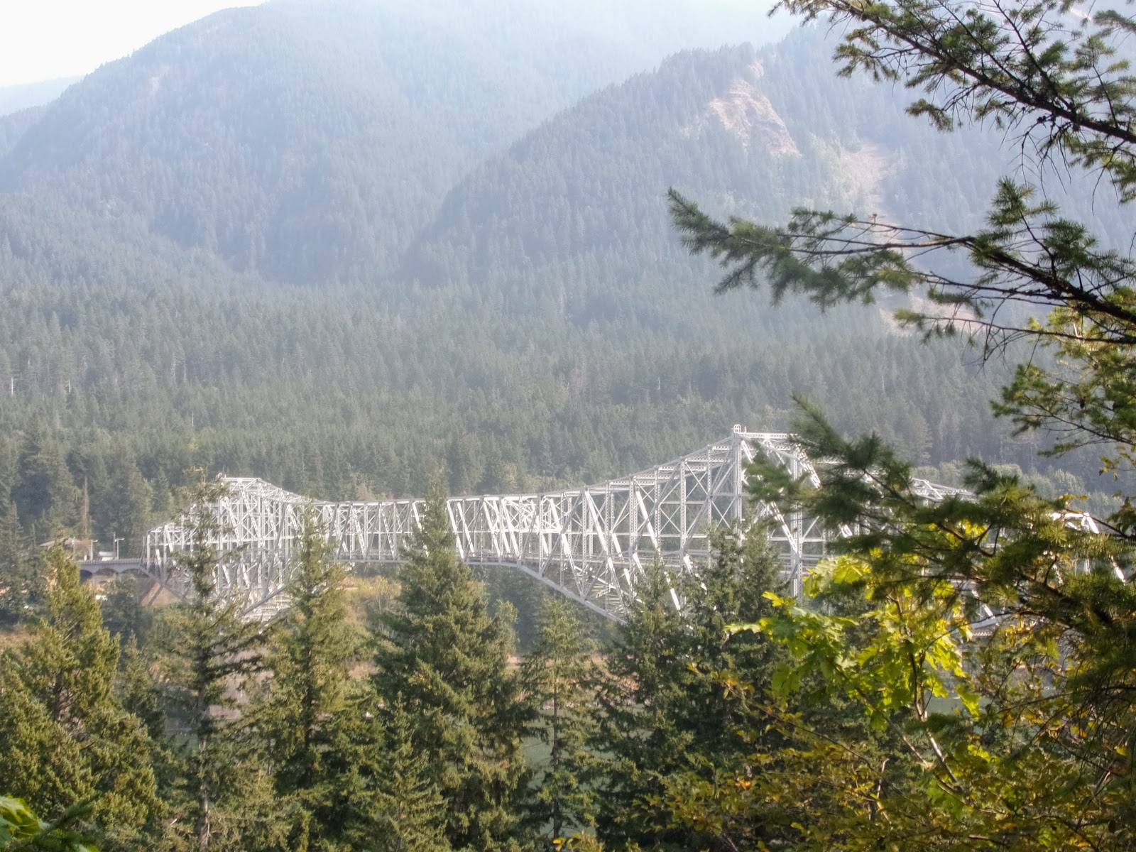
Bridge over the McCloud River.
Then just sixteen miles down to Interstate 5, a nice easy walk, I'm there for 2:30, and now have a quandary, should I head to Dunsmuir as per my plan, or to Castella which doesn't sound much of a place, but is where the trail notes suggest.  Of course, I go with the plan, it means camping at an RV park, which I now have my doubts about, but I want to resupply at a proper store.  My route turns out to involve a half mile of Interstate Highway, oops, I end up walking along the railway instead, and then sure enough, the RV park wants $35, I am not paying that to camp.  I continue three more miles into town anyway, and the store is indeed good - couscous, 700g of cookies for $3, yay, and I also find pizza and beer, this is worth the walk.  Then a lady outside the store, hearing my plan to camp in the woods, gives me a bunch of grapes and a $10 bill - I am a hobo!  In fact I find a pleasant spot near to the Sacramento River, could be a lot worse.

The expensive RV park, or at least the neighbouring resort - where you could stay in an old railway carriage.

Photos to go with this post can be found here and here.