Friday, 20 December 2024

Greater Patagonian Trail : El Calafate to Tres Lagos

Kilometres this section : 142
Kilometres completed : 775

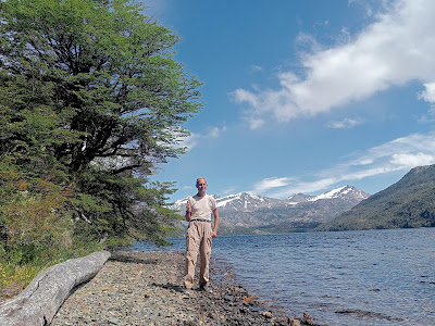
I don't get off to the best start in El Calafate, after checking into my hotel and putting my phone on to charge, I attempt to find the centre of town, and fail. Lots of empty lots here... But there is in fact a centre, grown up around the kind of sheltered creek I tend to camp in, and yes, a nice bar with a variety of tasty beer. Of course I have a day off here, washing, shopping - wow, Argentina is expensive, like, three dollars for 100g of own brand chocolate. 125g of Nescafé Gold Blend is twenty dollars! Good thing I am mostly living in a tent then... Sightseeing continues, I pass the polo club, then Laguna Nimez, where there are, in the far distance, flamingos. Back to the tourist area, and indeed the same bar - lots of foreigners here, much as with Puerto Natales, there is glacier trekking here. Better bring dollars with you though - I figured out the ATM issue, apparently you are legally limited to a withdrawal of 2,000 Pesos a day here. Perhaps enough to buy a packet of crisps... In the end I find a place to change my Chilean Pesos for Argentine ones resulting in a thick, heavy stack of bills.

From El Calafate I walk back to the east, on various gravel tracks, or sometimes just gravel. To my left, Lago Argentino, and for a while the town's airport, honestly it isn't too exciting. Good then to reach the bridge over Rio Santa Cruz, the rushing blue water is most picturesque, I am surprised to see it flows out of the lake - and indeed all the way across the country to the Atlantic. My route takes me along the river for a short distance, there's a beach and I can't resist a paddle. Thankfully it also goes through my filter well enough to produce drinkable water. From here, well, I can't help but notice I am now walking across a desert, I keep stopping to empty sand from my shoes, then camp on sand. It's not one of those cold deserts either, the next day is baking, the sun blazing down, my chocolate melts in my pack, water is gone by mid afternoon. Something of a disaster then to reach a river near the end of the day and find it completely dry - my water for the remaining 70km to Tres Lagos is meant to come from here. OK, a kilometre back was an Estancia, there's a guy there, can't understand a thing he says, but he lets me fill bottles and even gives me another one...

I am rather relieved to wake up to an overcast sky, looks like it's raining not far away in fact. This makes for easy going along the dirt track I've been on for a while - actually a public road, provincial route 21, I have seen precisely one car. I pass through some rocky terrain, then leave the road for a few hours straight across the desert. Time to think about camping, but of course it is too windy, I keep going, join a road with actual tarmac running along a winding valley, and now the wind is absolutely crazy. No choice but to keep moving, until in desperation I pitch the tent in the small sheltered area leading to a channel under the road, I guess at some time water runs through here but it is dry now. And I am sure the three skeletal sheep, still with wool, huddled in the channel won't bother me...

Next day I make a coffee with my last water, and emerge from the tent, if anything the wind is even worse, thank heavens mainly from behind, but I can barely stay upright. I stagger along, using my poles held in front of me as if descending a steep slope rather than a gently inclined road. At least it isn't far now, I get through it, and in Tres Lagos people tell me the wind was up to seventy km/hr. Wow. Well, I am early enough to take in the whole town, it is not big. There's actually an albergue here, but the people there say I need to go to a nearby office which is of course shut. To the lone hostel, nobody answers the bell, OK, the campsite it is. Very nice place except for the wind. Indeed, Tres Lagos is cool, kind of a trail town in search of a trail, as well as accommodation there is a cute museum, and many little stores, most of them sell granola bars. Of course I take a day off, the wind doesn't stop, but I manage to walk a little way, to see La Piedra Clavada - an implausible, 20m high diamond shaped rock, perched on one of its points. How the thing doesn't just blow over confuses me. Back to the campsite, and a large plate of spaghetti bolognese, excellent.


Saturday, 14 December 2024

Greater Patagonian Trail : Puerto Natales to El Calafate

Kilometres this section : 258
Kilometres completed : 633

I totally deserve a rest day in Puerto Natales, a couple of nights in a hostal it is then. Interesting place this, a pretty substantial town with a ski resort vibe - lots of hostels, lots of bar restaurants with tourists sitting in warm jackets and hats. The difference is, these people aren't here to ski, but rather trek on glaciers and look at penguins - there are many options for one or more day excursions. As for me, well, I think there is an actual GPT section to the northwest, not far from here. Unfortunately as with many of these sections, particularly in the south, it's a dead end unless you are prepared to take to the water. Apparently the thing to have is an inflatable boat... well, I do of course, but it is way too heavy for me to carry on trail. OK, spend much more money and you can get a lighter one, but honestly paddling across and walking like that seems... challenging. Not least we're talking regions that are completely uninhabited, so how do you get food? Well... the route from here would be through the Torres del Paine national park, it does look awesome, but other than taking to the water on the other side of the park, I'd need to cross into Argentina, and I see no evidence for a border crossing at the spot in question.

So... from Puerto Natales, I am walking northeast, on a road again. Not that exciting, but easy, a lovely day, and pretty country. This way, there definitely is a crossing into Argentina, I get my exit stamp from Chile OK, walk 5km of scenic no man's land, will Argentina's border control let me in? Well, the big 'Las Malvinas son Argentinas' sign is not encouraging, but I have no trouble, then a lovely woodland path takes me down to Rio Turbio, a little town that I think is a small ski resort, no snow now though. Also no cash for me, the ATMs here don't like my cards, I might be stuck paying with the credit card here.. well, it works, I get beer, odd pizza, and find some woods to camp in just out of town.

From here, a lot more road walking. It is easy of course, and the surroundings are majestic in their way, endless deserted grassy slopes, clumps of forest here and there, and to the northwest snowy mountains. I aim for 40km a day, a decent pace but not too much. Wow there's not much here, it seems hospitable enough, sheep and cows graze, I spot another rhea, and many cute little foxes, but no human habitation until near the end of my second day in Argentina. There is some kind of provincial police building, and next to it I think a restaurant? Or maybe not, I think it must be accomodation attached to the office, but the guy there not only gives me water, but even some bread and churrasco! Such hospitality, I am liking this part of the world.

From here I turn off the main road onto one with a gravel surface and few cars, good, this is more like real hiking. Clearly this is not a road much used by locals, over a day a few campervans go by, one van stops so they can give me a banana, most kind. A couple of cyclists struggling with the gravel, then two more, spending the night at an abandoned police station, while I camp by the nearby river. I must come here and cycle some day... Lovely weather now, it is genuinely hot , during the day at least, and I keep to my 40km per day. North of that police station, a minor road on the map, but a nice gravel track with zero traffic in reality, I am out in the wild now. I do revisit the main road briefly, and as usual have to persuade people that no, I don't want a lift. Then back into the wild, by now the surroundings seem pretty dry, sand, gravel and sparse clumps of grass, though plenty of dry mud too, it must rain, or maybe snow, some time.

I make my way down into a broad, windy valley and camp in a dry creek bed. From here, a glorious, if windy, section. The land grows increasingly dry, I walk over packed sand and pebbles, almost no plant life around. Then to the shore of milky white Laguna Sarmiento, I planned to fill bottles here, half a bottle of brackish water is all my filter can manage. Up over high moorland, then a stunning gorge opens up before me, Rio Bote sparkling at the bottom - fresh water is most welcome. Up again and I finish the day walking down to the road with more great views, this time of Lago Argentino, and maybe even a glimpse of sunlight glinting off glass in El Calafate in the distance. Not too much distance though, 25km or so, easy walking along the road and I am there by mid afternoon the next day.


Friday, 6 December 2024

Greater Patagonian Trail : Punta Arenas to Puerto Natales

Kilometres this section : 265
Kilometres completed : 375

I enjoy a day off in Punta Arenas, this involves shopping of course, plus sightseeing - there are many monuments and statues, including Mahatma Ghandi, and Luis Pardo, who captained the Chilean ship that rescued Ernest Shackleton's stranded crew.

And, back to the trail, north into wooded hills, without difficulty this time except the weather, can't be good every day I guess, there is a cold wind and persistent light rain.  Still a fine walk, then down on gravel tracks to a windswept plain, it is impressively bleak.  I make good progress, but camp a little early in a somewhat sheltered spot by a stream - I have a lengthy section of shoreline coming up, doesn't look like there'll be shelter there.

Sure enough it is bleak and windy by the water, which I think is a substantial inlet.  Fine walking though, as is the whole day, grassy heathland, then up on to a moor, sometimes on gravel tracks, sometimes just turf.  Rather glorious, although the constant wind is biting cold - at least, mostly sunny today.  And many animals to see, sheep of course, also wild horses and alpacas, and at one point I think a pygmy armadillo!  So a good day, and a long one, over 45km.

A cold night, thanks to the wind seemingly straight from the Antarctic I guess.  It is still blowing as I walk, briefly on a road with actual cars, then a gravel track heading north.  It is flat, straight and easy, good walking but for the constant wind.  To my left I pass Laguna Blanca, it is pretty big but I keep on, as does the wind, cold enough that I have all my layers on.  One point of interest is La Cueva de la Leona, a rocky gorge that apparently has centuries old indigenous art.. I continue around the Laguna, finally climbing a bit to pass the substantial Estancia Laguna Blanca, and on to a magical grassy plateau.  Still too windy to camp, I finally spot a grove of stunted trees, shelter enough.  A little over 50km today, and another interesting animal sighting - this time a rhea - South America's answer to the ostrich.

Another day, and the wind still blows, as I follow more gravel tracks over the bleak landscape.  Not that I need them, an off piste section later is easy going on springy turf.  After that I join the highway between Punta Arenas and Puerto Natales, the only substantial settlements in this isolated bit of Chile.  It's still only a single carriageway with not much traffic, easy going except for the wind.  One benefit to being on a road, I pass a roadside restaurant!  Not exactly haute cuisine but I get soup, stewed beef and mash, protein and carbs for the win, and even a couple of beers to wash it down.  So what if it is nearly 8pm when I get the tent up among some scrubby trees near the road...

I am very glad to have some sunshine, and even better, rather less wind, the next day.  All on road too, easy then, I march along, a range of snowy mountains getting closer, that will be the Patagonian Andes.  I'm not going there, pretty sure they're on various islands for one thing.  I stop at another cafe for a late lunch, the meat and cheese sandwich turns out to be a vast thing, disk shaped, it contains melted cheese, and huge quantities of steak in gravy.  Good though, I eat the lot, then struggle a bit with walking a further 20km.

Another 20km or so of road, and then some relief from it, I take a gravel track to the left, of course climbing a gate to do so and swiftly reaching a substantial estancia.  Here there are friendly dogs, and indeed a local, he doesn't object to me being here, but is a bit confused by my plan to walk to Puerto Natales.  What, it is only another 20km!  Well, to begin there's a lovely grassy track, this is more like it.  Sadly the next bit is 4km or so off piste, and rather than the grassy pastures I've been walking past, I get bog, then dense forest I can barely squeeze through.  I am glad to find quite substantial paths made by cows, they get me through this, then an easy last section into town, and a proper bed, yay.


Friday, 29 November 2024

Greater Patagonian Trail : Cabo Froward to Punta Arenas

Kilometres this section : 110
Kilometres completed : 110

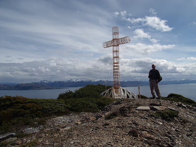
From Punta Arenas I take a bus south, as far as the small settlement of San Juan.  From here it is a... challenging 45km walk to Cabo Froward, but I do make it in less than two days.  The trail begins at a giant cross, with fine views across the Strait of Magellan towards the snowy mountains of Tierra del Fuego.  Now of course I need to retrace my steps, at least I know the worst.  Well, the cross is of course up a large hill, the descent is easier than the climb was, then a bit of pebbly beach - I'll be by the sea all the way to San Juan.  Sometimes of course there's a cliff where sea meets land, obviously this means a steep, muddy climb and descent.  It gets worse, a section of beach covered with fallen trees to climb over... well, that will do for what is left of the day, time to camp, and even make a fire.  I am probably not going to get fined here.

So you may be wondering, what is this 'Greater Patagonian Trail' then?  Well, it isn't any sort of official path, I don't know if I will see any signs.  Rather the whole thing seems to be the brainchild of one guy,  a German named Jan Dudeck.  Fair play to him, he's clearly spent an awful lot of time exploring Patagonia, and I hope to walk many of his routes - but that is the thing, 'routes'.  There isn't a continuous line, and not much at all here in the south, so for a while I will be following my own plan.  What can go wrong?

First full day of my route north, and I am still retracing my steps.  Lots more clambering over rocky coastline, and two rivers to cross - I had to swim both to get to Cabo Froward, not ideal this close to the Antarctic!  Today I swim the first, then for the second the tide is out, it's 'just' a waist deep wade.  At least the sun is out, in fact it is warm, t-shirt weather, although I was glad of all my warm gear in the tent last night.  The rest of the day is easy enough, a climb over a hill with actual bog, sandy beaches and pleasant paths through the forest.  With the lovely weather and fine views of the sea and mountains it is all rather splendid.

Another day and a bit more beach, to Faro San Isidro, the most southerly lighthouse on the mainland of course.  From here the route is better travelled, the beach is the same but the trails through the forest are easy now.  Then onto dirt road, for 10km to where I got off the bus, and a few km more.  Lots of holiday homes here, although not exactly deluxe - seems to be a popular idea to tow a broken down campervan here.  Well, onwards, I could of course just stay on this road, but surely I can do better... Well, I do have to climb a fence with 'privado' on it, sure it's fine though - there are certainly plenty of hiker footprints.  And glorious walking through natural parkland, then a steep ascent to an antenna around 400m up.  A footpath through the trees, then logging trails - one worry, my map shows a trail just stopping, the plan was to make my way off piste for a bit, but the trees look densely packed.  Fortunately the trail does not stop!  Time to camp then, tomorrow I'll see where it goes.

Well, the mystery trail takes me a little further, but then turns west, not good - I keep going but it doesn't turn north, OK, back I go, there is maybe a track leading north, looks like it hasn't been used in a while.  Of course a little later it vanishes entirely, I find myself struggling through dense undergrowth and masses of fallen branches, eventually I reach another logging track but it has been two hours and less than 4km along the route.  Next up, a track on my route turns out not to exist - there is just a fence leading into the trees... I see an alternative on the map, definitely showing as a minor road, but it is a fence too, sigh.  OK, decision time, the track I am on leads down to the coast road to Punta Arenas, so that is where I go.

It makes for a quick walk at least, although with endless fencing to either side it is not obvious where to camp - I find a spot by the beach in the end.  From here it is an easy morning's walk back to Punta Arenas, interesting though as I pass the rusting hulks of many large ships.  Good to be back in civilisation, and over a day early too, time for a nice rest then, and maybe some beer.


Saturday, 23 November 2024

Greater Patagonian Trail : Intro

Adventure time again!  It's been a while since I attempted a serious bit of walking, well, Covid and then teaching got in the way.  So, where to go?  Well, given the time of year, the southern hemisphere makes sense, and I fancied visiting a country I've never been to before.  A bit of research and I came up with... Chile.  The plan is to head to Cabo Froward, which is the southern tip of the main landmass of South America - yes, plenty more land further south, but all islands of various sizes.  From Cabo Froward I will walk north, I do have a plan but no idea how far I will get.

It is of course not easy to get to such an isolated spot, and starting from Thailand, 'just' the other side of the Pacific, doesn't help.  Three long haul flights, one after the other, via Vancouver and Toronto, gets me to the capital, Santiago, where I can rest for a night.  I am not loving the packed streets around the bus station, market stalls crowd the sidewalks and often fill the road and progress is slow.  It is quieter near my hotel, and general impressions of Chile are good.   I buy a very tasty empanada - they are everywhere it seems.  I also find some tasty beer and of course a burger, and the breakfast at my hotel is excellent.  All pretty cheap too.

Two more flights the next day, wow I am such a jet-setter.  At least this time only one plane is involved, it lands at Puerto Montt, I stay on board and a little later it takes off for Punta Arenas.  The whole thing goes without a hitch, and I am in time for some beer and tonight, pizza.  Punta Arenas is nice, pretty big but with a frontier town feel, lots of wooden houses.  I spend a day shopping, gas for cooking, trekking poles, and of course lots of food.  I will be back in a week, I can do some sightseeing then..

Monday, 8 July 2024

Munros 2024 : Kinlochewe to Dingwall

Munros this section :
Slioch
A' Chailleach

A' Chailleach summit.  I had already decided 'no more' by this point...
My second day off in Kinlochewe, time for a rest, oh hang on, no, for some reason I decide to spend the day making my way up Slioch, the Munro I missed a few days ago - not like there is much else to do here it has to be said.  Well, it's easy enough to retrace my route past Loch Maree, then a long climb, with path all the way, this is not so bad.  It only rains some of the time, and I get one more selfie in cloud with a pile of rocks in the background, yay.

So, the last section, time to leave Kinlochewe with no hurry to come back, and it is raining of course, but slowly it stops, as I walk an easy ten km along a track.  I've been a little worried about the next bit, 13km of planned route with no sign of a path, starting with climb of Fionn Bheinn.  In fact the Munro is fine, a grassy hill, not too steep, even the weather holds off, though the summit is still in a cloud.  Dropping my pack one km from the top helps too, and I get back down to collect it at 3.30, with only 7km of the day left this should be easy.  I should be so lucky, rather I find my self struggling through truly awful, horrible bog, the rain returns, and my path is blocked by both deer fences and mountain streams swollen into substantial rivers I have no choice but to wade, one of them is waist deep...

Silver Bridge.
I sleep poorly, it may be July but I am so cold.  Next morning there is a Munro, A' Chailleach, nearby, I follow a stream uphill, there is too much rushing water to cross, but OK, it gets me onto a decent route to the summit.  But, this weather really is just too much to bear, relentless, driving, heavy rain, flung at me by a freezing wind strong enough to make walking difficult.  My hands and feet are numb, I can't do this any more.  I do get to the top, and just about use my bloodless fingers to take that so important selfie, the plan was for four more Munros today, but that is not happening.  One good thing, I meet an actual path here, I can follow it downhill, a long way down but in more good news, once I reach a loch I find a power company has built a little hut filled with humming machinery.  Not sure I should be in it but there was one of those combination lock key boxes with the code handily written next to it!  Anyway I grab the chance to sit somewhere dry, eat a big lunch, wring out my socks and generally shed water.  Looks like I can walk a road all the way from here to Dingwall, it is over 60km but I have more than two days, no problem - so, I walk a few of those km over a couple of hours and then camp.

The welcoming Ben Wyvis Hotel.
A genuinely easy last couple of days then.  I am 32km to Contin, seems there is campsite there which sounds good, and dare I say it the weather is actually ok down here, I am starting to dry off.  The road is actually a little busy for comfort, so it's good to find an alternative, the Two Bridges Trail along the Black Water River, then logging tracks to Contin - where obviously I get no response from the campsite.  Never mind, only two km more to Strathpeffer, a nice Victorian spa town, there isn't a pub here as such but several hotels.  One of then, the Ben Wyvis hotel looks super posh, but provides beer, soup and a hearty plate of chilli, and isn't even that expensive. The staff are lovely too, digging out a phone charger for me to use, my own being the latest casualty of the Scottish weather.  And OK, after dinner I have to go and pitch my tent in a wood, I can cope with this...  What is more I have practically made it to Dingwall, my last day of walking being an easy bit of footpath, finishing before midday.  Not a great bit of planning this, I have walked past several train stations to get here - I think I simply defaulted to 'make a circular route'.  Well, nice to be back in civilisation, I get lunch and a phone charger before taking the train to Beauly, a little nearer Inverness, where I have a campsite booked.

A somewhat more laid back walk in Beauly.  I liked the warning sign...
Beauly is nice, well, the name does come from the French for 'nice place'.  There is a Co-op, I decide to celebrate the end of the walk with a barbecue, many burgers ensue, and a few cans, and indeed a couple of beers at the campsite bar - I did say it was nice here!  And that is it, the next day various forms of transport take me away from Scotland.  And what can I say about this trip?  Ugh, well I guess doing this sort of thing you do run the risk of the weather not being great, and it was mostly pretty terrible.  This would happen when I clearly hadn't put enough thought into keeping things dry... Never mind, I did have some fun, saw some remarkable countryside, and that is thirty more Munros in the bag at least.  Well over half way through them now!

Photos to go with this post can be found here.

Wednesday, 3 July 2024

Munros 2024 : Kinlochewe Loop

Munros this section :
Beinn Liath Mhor
Sgorr Ruadh,
aol Chean-Dearg
Spidean a' Choire Leith
Mullach an Rathain
Tom na Gruagaich
Sgurr Mhor (Beinn Alligin)
Ruadh-stac Mor (Beinn Eighe), Spidean Coire nan Clach (Beinn Eighe)

The little bothy there was a pleasant respite from all the water.
Kinlochewe seems to consist of a hotel with a bar / restaurant, catering entirely to tourists, plus a village shop and a rather nice petrol station plus shop and cafe that do likewise.  Seems the place is a popular stop for people touring Scotland in various ways - cycles and motorbikes, campervans and even supercars are common sights on the roads around here.  Well, I am not the only one turning up on foot, and between the bar and the two shops there is everything I need, and despite my not doing much the day seems to pass quickly.  Next morning I wake to find my tent in a puddle, of course it has rained heavily all night, ah well, I pack it up, and note the strong wind blowing around Kinlochewe - I am sure this in no way bodes ill for the situation higher up - and head to the petrol station cafe for a fortifying bacon roll.  Then off, on a truly awful 'path', muddy and overgrown, no fun at all in the rain.  Of course I could have taken the road, I only didn't to avoid going the same way twice as this is a circular section.  Some respite two hours later, a gravel track, it is dry, there's even a bit of sun.  Then up to a pass, it's getting windy and wet, I walk packless up Beinn Liath Mhor, enduring the crazy weather, and yet again my reward is a wet pile of rocks in a cloud.  Down a bit, then up Sgorr Ruadh, an easy enough ascent but not fun in these conditions.  After that a long descent, it's my own route but it's OK.  Time to camp, of course it is still raining...

Maol Chean-Dearg summit - they will all be selfies in clouds from now on.
And still more of this, I start another day by walking straight up Maol Chean-Dearg, on a good path, but the weather remains grim, wet, windy and horrible.  Down the other side, once again a 'special' route of my own devising, so steep, it's very good to finally reach a well built trail, this is a nice walk although of course it is still raining.  Down to sea level, indeed I pass Torridon, on the loch with the same name, which connects to the sea.  I eat a late lunch here, at 2pm, according to my plan I still have two Munros to do, Spidean a' Choire Leith and Mullach an Rathain, and I decide to carry on, how bad can it be?  Haha.  A little bit of road to the trail head, then up, steps, they seem endless, into a cloud of course, it is wet and cold, the climb keeps coming, it does get a bit dryer, I can even just about make out the sun from the summit.  On the minus side it is 6.30pm, and I manage to faceplant taking a photo with the self-timer.  I probably should backtrack now, but the next summit is only 1km away... of course, there turn out to be many rocky pinnacles in the way, I bypass most of them on a path following a contour line, but that means a terrifying drop to one side.  Somehow I make it, then it's a long way down, I chose this way because it descends over several km, thinking it should be easy, in fact the path is rarely visible and of course there are many crazy steep bits.  I camp at past 9.30, still nothing like all the way down, and my sleeping bag is wet...

The first, and pointiest, of the horns.  I did clamber all the way up.
Ok, an easy day in theory, only two Munros, Tom na Gruagaich and Sgurr Mhor - both part of the Beinn Alligin mountain complex - and a mere 18km, however I make a late start, and then have to descend from the camp spot, there's no path, and the route is still crazy steep of course.  I walk a bit of road, then paths leading up, I have to be careful navigating now, my GPS is not happy with the weather, it is showing the map, my position, and the location of the Munros, but not my planned route.  Well, the way up is obvious, there are more steps, so many steps, although at least it is dry for a change.  I see a lot of people, mostly passing me on the long climb, but still I make it up by 1pm.  From here it's an easy ridge walk to Sgurr Mhor, now I just have to get down - ah.  Various people had mentioned something about 'horns' hereabouts, I was thinking maybe those mountains I climbed yesterday - but no, rather my route down today involves clambering over a series of aptly named rocky pinnacles - well to be fair I find a contouring path to avoid the worst of the second two.  I get through it, am briefly rewarded by the sight of the sun, of course I haven't actually lost much height so there is still a steep descent, but then some good trail and I'm in the tent before 7pm.

Haggis!
Another supposedly easy day, again only two Munros, and this time just 16km, and there's even good trail to start with, though unsurprisingly I then have to turn uphill.  It's a well walked path, but long, and of course wet, and then I get to an insane scree slope, it just keeps getting steeper, eventually I am clambering up to reach a ridge.  I can at least drop the pack here, for an easy enough climb up to Ruadh-stac Mor, then back to get my pack and oh joy, lots of bouldering up to Spidean Coire nan Clach, all the while battered by a brutal wind, it is just so horrible.  All this for two selfies in cloud.  The way down is OK but long, it is 3pm by the time I am low enough that I can pause for lunch.  Then down even more, so good to meet a road, from here it is not far back to Kinlochewe, where I retire to the Stag Highland Restaurant for, well it has to be haggis.

Photos to go with this post can be found here.

Tuesday, 2 July 2024

Munros 2024 : Ullapool to Kinlochewe

Munros this section :
Seana Bhraigh
Eididh nan Clach Geala
Am Faochagach
Cona' Mheall
Beinn Dearg (Ullapool)
Meall nan Ceapraichean
Bidein a' Ghlas Thuill
Sgurr Fiona
Ruadh Stac Mor
A' Mhaighdean
Beinn Tarsuinn
Mullach Coire Mhic Fhearchair
Sgurr Ban

T-shirt weather on Cona' Mheall.
I pack up the tent, and while doing so, nearly lose the tortellini I plan to have for dinner to a thieving seagull.  Having avoided that disaster, I walk straight up out of Ullapool, on a nice track past a loch, this is the Cape Wrath Trail apparently, an unofficial route leading to the most northerly point of the UK mainland, this explains why my map labels many of the paths around here 'cape'. The track turns into a path, then vanishes a few km from today's Munro, Seana Braigh, well it's dry enough underfoot anyway, and the sun is out, making for a pretty easy ascent, and a view at the top, though it's very windy up here.  Down the other side, and I see a couple of tents, two guys basically doing the same as me but in the other direction.  I don't go much further before camping myself.

Off to the coffin road.
For the second day of this section, I've planned five Munros, argh.  Well, I get up Eididh nan Clach Geala easily enough from a high start, reaching the summit by 10am.  I am walking without a path for most of the day, the ground is dry enough at least but this makes for slow going to the next Munro, Am Faochagach, for which I drop my pack for a relatively easy climb up and down, it is a sunny day though and this is hot work!  I then panic as I only have four Munros marked on my electronic map, it's a relief to realise I just forgot to mark the next one, Cona' Mheall.  It's a steep slog up, and the last 100m is scary clambering over rocks, good to get to the top, as luck would have it another chap is there, he helpfully takes my photo.  It's getting late, I am on a path now at least, and can lose the pack for both the remaining hills, Beinn Dearg (Ullapool), and Meall nan Ceapraichean, the first is a high mountain, with some patches of snow and also a wall built of huge boulders in some earlier age.  I enjoy great views, mountains all around, the Summer Isles and far out to sea, but this is such a long day, it is past 7pm at the last summit, and I still need to get down, on a nice path but no camp spot to be seen, it is nearly 9pm when I find one.

Bidein a' Ghlas Thuill summit.
The next morning my feet are sore, I still have a lot of descent to do, and am maybe 5km behind plan.  Nice weather again at least, and only two Munros today, but still the walking involves much up and down.  I reach a road, I'm not on it for long though, time to walk the coffin road, a long path over to the next valley, where again I cross a road then climb, on what is a path on the map, but in reality is barely there, at one point I even need to wade a burn.  My planned route up the first Munro, Bidein a' Ghlas Thuill, turns out to be a crazy line over a series of crags, fortunately there's an actual path which is not much longer, though very steep.  I get up the thing, there's a great view out to sea, and from here it's not far to Sgurr Fiona, the route between the two Munros is across a windy saddle, and I reach the summit at 7pm.  From here a marked path leads away, I hoped this would be an easy descent, but instead it is scary contouring above a cliff, then down a little bit down to somewhere I can camp, I am 6km behind now though.

High altitude camping.
I wake at that high camp spot, it's a long way down from here, and the descent turns out to be a nightmare, so steep, then a high deer fence to climb, more steep downhill, I even have to backtrack to avoid a cliff, and then another fence, argh.  I eventually get down, to my planned walk past the end of a loch, which of course in the event is blocked by a deep river flowing into said loch, OK, I walk upstream and eventually I can ford the thing with no more than wet feet.  Then there's an actual path, it is nice enough, and finally I reach the point I should have started from today, at midday, hmm.  Up Ruadh Stac Mor, a packless walk to the top, but it is 4pm by the time I reach the summit, and I am supposed to do four more!  The summit is, of course, in a cloud, but at least it's still not raining.  Down I go, grab my pack and head towards A' Mhaighdean, it is the other side of a saddle, easy enough to climb and again the summit is in a cloud.  From here it's a gentle route down, but all the way to 500m, not good if I want to climb any more mountains today.  Well, I ascend a bit but it's past 6pm now, I just can't go up the next Munro now, let alone the other two.  Camp it is...

It actually made for a good walking surface.
For a wonder I wake to a sunny day, time to get up Beinn Tarsuinn, it's an easy start but then the final approach is along an insane ridge, lots of clambering is involved.  I make the summit just in time for a view, right after it clouds over, and I head down, then up to Mullach Coire Mhic Fhearchair, in a cloud of course, and the howling gale is back.  Down again, to a saddle, I drop my pack and make an easy ascent of Sgurr Ban, a summit in a windy cloud yet again, but I am there for midday, this is good.  Then my own route down from the saddle, it's actually OK, a gentle slope and then a substantial piece of exposed rock to walk down, very cool.  One problem, I have a campsite booked for tonight, and have still not reached the point where I was meant to start the day.  OK, I can save a lot of time by not going up the planned Munro, Slioch, instead I stay on a marked path, good that there are no more hills, but I had hoped this would be easy and it's really not.  A steep climb up to a pass, and at 4pm I'm finally where I should have started, this is so hard, a section of trackless bog, more up and down, and finally a flat path by a loch.  I arrive in Kinlochewe at 7.30, just in time for a burger.

Photos to go with this post can be found here.

Friday, 21 June 2024

Munros 2024 : Lairg to Ullapool

Munros this section :
Ben Klibreck
Ben Hope
Ben More Assynt
Conival

The Broch.
I depart late from the campsite, wasting time trying to solve the mystery of the missing cheese - this is my lunch for a couple of days, but of course the solution turns out to be that I simply forgot to buy it, oops.  Not ideal, this is a long day, with 15km of road just to start, through bleak surroundings, bog and forest, and little sign of humanity, barring traffic on the road, including numerous cyclists on their way to John o' Groats.  The weather is horrid, constant driving wind, against me of course, and yes rain.  It's a long climb up Ben Klibreck, at least it warms me up, not much fun though, and my camera doesn't like the weather either, I need to dig my phone out for a photo at the top.  I finally emerge from the cloud on the other side of the summit, and there's a fantastic view, the empty land stretching out below me.  Back down then, to a loch, and camp by a river at 8pm, no problem with still two hours of daylight remaining.  More oops though, seems I left two tent pegs in Lairg...

Ben Hope summit.
Another day, and much like yesterday, there's cloud at ground level, a strong wind blowing it into my face, and a long road leading north through bleak and uninhabited terrain.  Eventually the cloud rises and it is actually sort of dry, though still windy.  I pass a track heading west, I will be going this way tomorrow, but first I have to get up Ben Hope, the most northerly Munro, then retrace my steps.  In fact, I reach my planned camp spot around midday, it is by the remains of a 'broch', a two thousand year old stone tower that must have been an impressive piece of engineering.  I may as well put the tent up and leave it here, and lacking cheese for lunch I cook up a spare pack of noodles.  From here the road runs north along a dramatic narrow valley, then I turn right to take a steep track up the mountain, the first 200m alongside a series of awesome waterfalls.  But from then on the ascent of this isolated mountain, from which no doubt there are views out to sea on a clear day, is a grim, relentlessly wet slog to see a trig point in cloud.  Everything I have with me is wet now, I hope this gets better...

Camped by Loch Cam.
Another long day, this one is 42km, I am not really in the mood to walk along a road in wet shoes and socks, but it is what it is.  At least I am going south now, the wind may be blowing from the arctic but it is behind me, and even more or less dry.  That turn off leads to a well made track, courtesy of the water company I think, unsurprisingly it goes past past many lochs, this is easy going through bleak but beautiful country.  Then more road, oh wow the sun is out, then an electric company track that is basically a road, my feet are actually drying and I am getting to the end of the long distance, it wasn't so bad.  I can see a Munro, Ben More Assynt, and that could be nearby Conival behind it, well they can wait 'til tomorrow.  To end the day I walk alongside a massive concrete pipe, an aqueduct feeding a hydro power generator of course, and camp near it.

With Peach (centre), and Horne.
Emerging from the tent, I can see clouds high in the sky, and the rocky summit of Ben More Assynt not far away, let's do this. I get a fair way up on a decent gravel track, then the climb is easy enough until 200m or so of boulders before the summit.  There are fantastic views from up here, I can see Ben Hope to the northeast, my phone works well enough as a camera, and it's not far to Conival, but the insane wind blowing over the saddle on the way makes it exciting.  I reach the summit OK, from here the plan was to go south, but it is a knife edge ridge with a cliff to either side, I don't fancy it.  Instead I follow a well used path north, this is a lovely walk, the sun comes out, and I can see the sea, not far away from the looks of it.  After a steep descent I follow a stream east to reach a road, returning to my route from here would be a long way, but can just road walk to Ullapool, it's not too far, and I planned to get there tomorrow anyway.  I have time to get some of the way, then leave the road on a handy path to camp by a loch.

Rather pretty on the approach to Ullapool.
It is not too far to Ullapool now, road all the way of course, it is too busy with traffic for my liking but very scenic. There is interesting geology in these parts, I read many informational plaques, and pose with statues of Horne and Peach, whose survey of the region helped to explain its complex geological history.  It's a nice day again, there seems to be a marked contrast between here and the east of the country, the landscape is green, cows and sheep graze, it's even warm.  I cross a high point, and wow what a view, out over Loch Canaird to Isle Martin and the sea.  I walk along a gravel beach, then a bit more road to Ullapool, where there is a campsite, a pub, and even a curry house in close proximity.  Ullapool is nice if a bit small, a fine place for a rest day anyway, I of course shower, wash my clothes, and shop, and there's phone signal, I get to contact the outside world.  Before long it's evening, so back to the Arch Inn, there are cairngorm ales, and they let me bring in a pizza, from an enterprising bunch with an oven set up in a nearby lorry - pepperoni with hot honey.  And, there is even live music!

Photos to go with this post can be found here.

Saturday, 15 June 2024

Munros 2024 : Dingwall to Lairg

Munros this section :
Ben Wyvis

Back in Scotland.
What, more walking?  Well, this should be rather different to Spain, I am in the Highlands of Scotland, spending a month climbing more Munros, should be good exercise and given it's June, maybe there'll even be nice weather!  I start with a flight to Inverness, then a train to Dingwall, where I camp next to Ross County's football stadium.  The walking starts with a climb of course, on roads at first, then a track, which after a while abruptly disappears.  For a couple of km I struggle through some really nasty bog, at one point my right leg sinks in up to the hip.  It is a great relief to find a path again, and it leads up Ben Wyvis, the first Munro of the trip, with a fine view, out to the sea one way, and more mountains the other.  I take a stony path down, down, then follow a river for a km to my planned camp spot, but oops, seems this is the heart of the Wyvis estate.  Well, I am OK to walk a bit more, to camp up on a saddle.

Loch Glass, probably.
There are two days with no Munros now, well, the first is still very scenic, I walk past lochs, up into proper wilderness, with descents to more estates, Kildermorie, then Glencalvie, I'm not sure if I'm technically allowed to walk past the palatial buildings but nobody stops me.  My route follows the very pretty River Carron, rushing through its rocky course, sometimes on the banks are great boulders of quartz.  I camp beside the river, near one of many fishing spots.   It's nice, but the next morning I am beset by midges, well it makes for a fast start, indeed this should be a fast day, all road, and I am 6km ahead of my plan.  More lovely surroundings, I follow the river down to the sea, a substantial inlet of course, on one side Ardgay, then Bonar Bridge on the other.  From here I follow another river, the Shin, upstream for a fair distance, past the scenic Falls of Shin, where salmon will be leaping in a month or two's time, and on to Lairg.  This was meant to be my camp tonight, at a little past 2pm I have made great time to it, but sadly the campsite here is no longer taking tents, so I am booked into a place fully 6km further.  I was vaguely thinking of buying something to cook there, but an evening in a campsite in the middle of nowhere doesn't really appeal, so, I walk there and then back to Lairg.  Worth it for a nice pint or three of Black Isle Blonde, and a highland hotdog - yes, it has haggis on it.

Snug in the snug.
I take a day off, after only three days of walking, so lazy.  Well, yesterday was a bit of a slog in the end so nice to relax, wash stuff and yes, go to Lairg again.  Not a big place, but nice views of Little Loch Shin, and the dam holding back Loch Shin, which surely should be Big Loch Shin.  On the little loch is a small island with a charming Wee Hoose - allegedly a successor to a full size house and distillery, located on a rather larger pre-hydro power island a century or two ago.  As is often the way in Scotland there's a woodland walk with carved wooden animals, and I even find a second bar, the Nip Inn in the Highland Hotel.  Then back to where I ate last night, the very comfortable snug in The Pier, and a plate of tagliatelle.

Photos to go with this post can be found here.

Monday, 10 June 2024

El Camino del Norte : Sobrado dos Monxes to Santiago de Compostela

Kilometres this section : 61
Kilometres completed : 845

Not far to go now.
It really is not too far to go now.  Not wanting to go hungry again, I wait for shops to open in Sobrado, and buy some bread for lunch - I already had some chorizo, it has been sitting in my pack for a couple of days in fact - I wasn't hungry enough yesterday to eat it with no bread!  There is walking to do of course, the way keeps on southwest, through woods and fields, I am feeling a bit tired for some reason and don't pay much attention.  At least today I get to eat lunch on time, and shortly after that the Camino del Norte joins the Camino Francés, at Arzúa, lots to see here as I recall but I have no time to waste.  Well, that said I do find time for a beer a little further on at the Casa del Horreo, in my defence I need a stamp, being into the last 100km on which supposedly you need two per day.  Onwards, to Salceda, there is really not much here, and indeed most of it seems to be shut, well, my albergue is open, and I manage to get a bacon and cheese bocadillo from the bar next door.

Massive albergue on the Monte do Gozo, the music festival can be seen in the background.
The last day, this is probably a good thing as I need a rest.  And, only 26km to Santiago, this will be easy, haha.  I follow a familiar route, through O Pedrouzo where I started the last day a year ago, past the airport, to reach my albergue for 1pm.  Because, as it turns out, it is fully 10km from Santiago - well, it was the nearest I could get, I didn't realize it was so far out though.  It would be nice to at least check in now but of course it is not open yet, OK then, I schlep on to Santiago, and the reason for the lack of accommodation becomes clear as a music festival is happening on the Monte do Gozo on the way into town. I make my way to the centre, and it takes 30 minutes to get my certificate, pretty fast really as there's a big queue - nearly two thousand pilgrims have arrived already today.  I get a photo by the cathedral, then of course walk 10km more back to the albergue, which is now open and very nice.  And of course there is a bar, well, time for a celebratory cigar which I have been carrying from Bilbao, and tonight I get a burger, and even treat myself to a dessert, appropriately enough it is Santiago cake.

With my Latin certificate.
Well this was very cool.  Despite finishing in Santiago once again, this route felt quite different to the Camino Francés, wilder and hillier, although certainly there was a lot of road walking, particularly in the first two weeks.  Sure, there was a bit of rain but I really don't mind, not least a warmish bed every night helps.  Well, almost every night, that one of sleeping rough wasn't great - clearly this is not a route on which you can just assume there will be an albergue.  And, whereas last year many of my days were too short, i think I may have erred the other way a bit this time, not least there were a bunch of places like Avilés which I could have spent more time in.  Well, maybe some other time, or indeed there are still many other ways to get to Santiago, and incorporating the Libaniego route seems an idea too.  Now I know to avoid French trains, what can go wrong?  No issues with Spanish police this time anyway.  For now though, I should probably go somewhere else.  I wonder where?


Photos to go with this post can be found here.

El Camino del Norte : Ribadeo to Sobrado dos Monxes

Kilometres this section : 131
Kilometres completed : 784

This path has been here a while.
So far the Camino del Norte has largely hugged the coast, but of course Santiago itself is inland, so the route heads southwest from Ribadeo.  It's another short day, I take it easy through forest, on various gravel tracks and minor roads, and as far as the weather goes, there are plenty of clouds today, but still no rain in Galicia.  I am sharing the way with many pilgrims now, and there are not many places to stop, it's not exactly wilderness but civilization is limited to small villages, I don't see so much as a cafe until after lunch.  Today's stop is Vilanova de Lourenzá, it is pretty small but has an impressive church and tower, and a rather classy albergue.  I eat so much food, a menu with spaghetti then grilled pork and chips, and bars give me chorizo, cheese, empanada...

Hórreo!
Another day, and it is easy again, although the last such I fear, after today things get more strenuous.  It is still not raining, it seems Galicia has better weather, and it's also nice to see skinny Galician horreos, although around here they are crazily high, Asturian style.  Nice walking too, more forest tracks and minor roads, to Mondoñedo, which must have been an important place once, judging by the big cathedral.  Then a lovely walk contouring along the side of a valley, a climb up to 500m, and then down to Abadín where I check in to another nice albergue.  It occurs to me that I should book something in Santiago, and wow there are hardly any beds to be had, I end up near the airport,  well not a bad thing given that I need to go there anyway.  As for tonight, yes it is yet another pilgrim menu, this one has 
cauliflower cheese with ham, merluza a la plancha, and a bottle of wine, yay.

Into the wild country.
Time to stop taking it easy and do some serious walking, for a couple of days anyway, 40km each day in fact.  Well, the weather is good, and it's flat, time to power on.  I can see this has been a popular route for a long time, as I walk over ancient bridges and paving, then a nice path through woods.  I make it to Vilalba by midday, time for lunch then, a nice place this, and it feels like proper Galicia, just as with many towns last year the route runs along a medieval street with decaying houses.  Back into the country, there are green fields, with interesting boundaries formed of thin, flat, standing stones.  Tonight I am stopping at Baamonde, the last place I don't have a reservation, but I've heard heard the albergue is big, and yes it has 70 beds, plenty of room for me.  No menu tonight, oh no, I will have to eat pizza again...

Monastry at Sobrado dos Monxes.
The second long day then, I make an early start at least, on a misty morning that turns into a nice day.  I walk on forest tracks, out  into proper wilderness, moorland and rocky outcrops, very pleasant it is, the only problem being that I go a long way with no food, I am not carrying lunch, and the occasional tiny villages have nothing in the way of shops or cafes, even when there's an albergue.  I climb up to 700m, and finally find a bar at 3pm, for a late lunch of empanada de atún.  It's really not too far now to today's stop at Sobrado dos Monxes, where there is a monastery of course, but not much else.  I do get another menu, macaroni to start, I pick out the pasta and leave the lamb, honestly it was way too much anyway, then the main is a really nice bit of fish.

Photos to go with this post can be found here.

Saturday, 8 June 2024

El Camino del Norte : Soto de Luiña to Ribadeo

Kilometres this section : 92
Kilometres completed : 653

Pico Paradiella summit.
I make a late start from Soto de Luiña, it is 9am before I am on the trail, and it's a long day, too.  There are two options, a coastal route or a longer inland alternative involving a large hill, I choose the latter of course.  Up I climb, to find a lovely ridge walk, although a section or two seem very seldom used, most pilgrims follow the coast no doubt.  Up to a 720m summit, worth it for a great view, though of course it is raining, then a long walk down, lots of mud, the path is more like a stream, I don't know about England, this could be Scotland - indeed there's gorse, peat, even thistles!  Back to the sea again, to Luarca, a lovely place nestled in a steep sided gorge, and I find a pilgrim menu!  Scorpion fish mousse, escalope, flan de queso, and some Germans give me most of their wine...

Luarca.
There is of course a steep climb out of Luarca, and this proves to be a pattern, up, a flat bit, then down to a river or estuary.  The never far away motorway crosses these on gargantuan viaducts, then often dives into a tunnel, whereas I have to climb.  I get lunch at a large town on one estuary, Navia, then carry on, there's some rain of course, but it's not too bad today, not that muddy.  And, an easy day, I get to A Caridá before 4pm, and check into a basic albergue, probably the cheapest of the trip at €8.  I decide against getting another pilgrim menu, given the option of artisan pizza with chorizo and local Cabrales blue cheese, this turns out to be a good choice as it is awesome.

Ponte dos Santos.
Another easy day, 26km, I am so lazy.  OK, there's some more up and down, but then back to the sea, a lovely bit of walking along a cliff, then some boardwalk past a beach, with great views all the way.  However, another really big estuary is coming up, and this time the route heads back to that motorway, and then crosses alongside it on a narrow strip of paving, some 600m in length, and a long way above the water, this is the Ponte dos Santos apparently.  I can't honestly say I enjoy the experience much, still I suppose having crossed the Bridge of the Gods in America, I might as well do the bridge of the saints in Spain.  On the other side is Galicia, and the substantial town of Ribadeo, and not far to an albergue, named A Ponte of course.  Whisper it, it has not rained all day.  I am not feeling hungry after yesterday's huge pizza, so once again pinxos suffice.

The Cargadero.
I take a day off in Ribadeo, the last I will have time for before Santiago.  It's not that big a place, but there are some things to see, although the most impressive building in town, the Edificio dos Irmans Moreno, is being renovated.  Still, there are the usual chapels, a marina, and the near the scary bridge is the 'cargadero', a pier that back in the day allowed a small train to deliver iron ore to waiting cargo ships.  There's a fort too, though of course it is locked up.  Well, I have another albergue to get to, some movement west has to be good, though it seems I overdid it, the place is a km out of town in retail park, ah well.  It seems empty when I arrive, well it is not on the trail I guess.  Back into town then, for more excellent pizza, so much meat!

Photos to go with this post can be found here and here.