 |
| Start of the Yorkshire Wolds Way - more or less. |
The festival season is almost over, and after that I have other plans - which will be revealed in due course :)
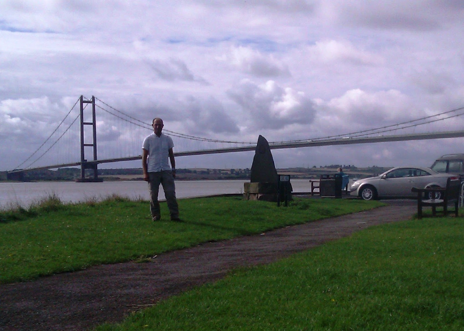
Before that, I have a few days free, so, time for some proper walking. Seem to have got quite a few odd days in over the summer, but I want to actually complete one of the long distance trails end to end. Thus I find myself staying with Chris in Sheffield again - when will I learn that a curry from his local takeaway is not ideal preparation for a hike? Then up bright and early the next morning, to ride along the M18 and M62 to Hessle, just outside Hull, and at the northern end of the really rather impressive Humber Bridge. This is the starting point for the Yorkshire Wolds Way, which at seventy-seven or so miles long should be just about doable in three days. Of course, by the time I've parked up the bike, had a coffee and so on, it is nearly 11am, not ideal as it is a twenty-six mile day. Time to get a shift on then. Well it is pretty flat walking along the Humber estuary, although the bit where you have to walk through the mud slows me a little. Then the route turns away, off into farmland, can't say it is terribly exciting, but it is nice to be out by myself, no responsibilities, no goal other than to keep walking until I've done the distance. In the event I get to my evening stop for 8pm, pretty good with a full pack, the owners say I must have run. Then in to the village, seems the pubs have all shut, but there is more of the ideal hiker food, curry. Hmm.
 |
| A glaciated valley. |
Day two, a 9am start, but I'm moving a bit more slowly I confess, body seems a little annoyed about yesterday's exertions. Today I begin to see why this route was chosen, as I walk into a unique landscape. The ground here is chalk, much like the South Downs, but up here they were beset by glaciers during the last ice age which cut easily through the soft chalk. The result, an array of steep sided valleys, dales in the local parlance. With no rivers running through them, they look like nothing so much as railway cuttings, all rather interesting. The route sometimes leads through them, easy enough, sometimes up and down the sides which is, um, tougher. And this is a long day, maybe as much as twenty-eight miles. By the time I reach the abandoned medieval village of Wharram Percy, I'm not really feeling much excitement, not least it is raining. But I press on, reach the campsite for not much after 8pm, it doesn't look too inviting though - I can see a few caravans, but the only sign says I'm on CCTV. I press on to the village of North Grimston, where thankfully there is a pub, the Middleton Arms. At first they say food is over, it is just me, the landlady and one old guy in there to be fair. But she relents and provides a sandwich and chips, and even better lets me camp in the beer garden.
 |
| Archeology at Wharram Percy. |
Day three, and I have about the same distance to do again, pleasant enough going to start with through a series of forest tracks. I'm not seeing so much glaciation today, rather a lot more agriculture, though as with the previous days the route doesn't go through much in the way of towns and villages. I don't know if I've passed a pub even... still, the miles roll by, after a while it becomes pretty much a straight line towards Filey, so when I do meet a valley it is straight down into it and up the other side. Nonetheless I make decent enough time, reaching a couple of huge caravan parks a mile or two outside town by 7.30pm. Had rather hoped given the size of these things there would be a bar and restaurant, but no such luck. And it is raining of course, using my phone to find a pub is a bit tricky, and in fact I'm not terribly pleased to have to walk all the way into Filey to find something to eat. Oh well, at least the beer is cheap, four cask ales on at £2.50 a pint cheers me up rather. Less good is when I return to the campsite, pitch my tent during which process the howling arctic gale which is what passes for the climate of Filey snaps my remaining undamaged tent pole in two. Oh well, the tent still refuses to die.
 |
| Carved acorns and twisted benches / in these ways shall ye measure the wolds. |
I knock the last few miles off the following morning, turns out the route finishes a mile or so outside Filey along the coast, obviously this means climbing up and down the cliffs a few times. Well, this was all fun, insane pace notwithstanding. No messing about here though, I have to get to Birmingham for, ahem, a music festival. Don't think I'll bother blogging about Moseley though, not sure the world needs to hear what I can remember of the drunken / hung over adventures of Austin's 40th celebrations.
Photos to go with this post can be found here.


No comments:
Post a Comment