Monday, 6 January 2025

Greater Patagonian Trail : Cochrane to Puerto Ingeniero Ibáñez

Kilometres this section : 154
Kilometres completed : 1,293

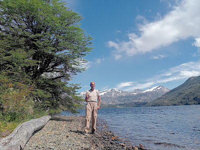
A few km of road takes me out of Cochrane, and to the entrance of Parque Nacional Tamango, I am expecting to pay a fee to get in, but the office is empty, it is New Year's Day I suppose.  There are various trails running through the park and I head off along one, Los Carpinteros, it runs alongside Rio Cochrane, then another trail, Los Coigues, skirts the western end of the huge Lago Cochrane.  Of course this means a series of near vertical ascents and descents, but here it is a lovely walk, these tracks are well maintained, there are wooden stairs and bridges, and someone has even cut back the grass!  The views over the lake to forested hills and snowy mountains are simply majestic, and I even see a huemul, a member of an endangered species of deer native to the region.  Only problem, it is slow going, I worry about getting to the next town in the four days I've planned, which would be annoying as I have a hotel booked.  So, on leaving the well maintained trails, I really need the next bit to be walkable.  Thankfully I get a well used path, even flat for a bit, then a steep climb on a track clearly used by vehicles, good enough, and from the high point, easy walking through lovely green valleys.  Still I only make 33km before camping, I will need to do better tomorrow.

My second day of the section starts with an easy, pleasant 20km on road X83, into Parque Nacional Patagonia.  Then onto Sendero Valle Avilés, following the river Avilés upstream, but this is not so bad, almost all up over many km, and not much down so the ascent is gentle enough, I make a decent pace.  The route has me wading the river just before I plan to camp, I hope it is OK, but in fact I hit a nasty crossing of a creek a few km earlier.  It's only a couple of metres across, but the middle is waist deep and the current is so strong, I can't get stable enough to take another step, I try and over I go, and end up floundering to the other side somehow.  A good thing it is a warm day, no harm done, and I cross the river itself easily enough.  I walk a couple more km to dry off, making for a rather better 41km today.  Lots of fords on the route for tomorrow, hopefully nothing that bad again.

As it turns out, the fords are OK, but there are so many of them.  It's a long walk down Valle Hermoso, it is indeed pretty, a broad gravel bed with a braided river threading through it, easy enough but with repeated crossings, I keep having to stop to empty stones out of my shoes.  Also the wretched insects are back, I think the spray helps a bit.  To Lago Verde, more blue than green, and of course, staying close to a lake means a brutal slog up to Portezuelo La Gloria, and it's just as steep going down, then it's time for more gravel and repeated wading.  It is very nice to reach Laguna Jeinimeni, which has an actual flat dirt road along the bank.  This leads to a popular campsite with various wooden shelters, and unbelievable numbers of caterpillars, I can't stop here though.  There's still 10 more km along a minor road, and I camp at 8 again.  But now, only 44km remain before that hotel room in Chile Chico.

It's so good to walk a gravel surfaced minor road, no need to wade raging rivers or watch every step lest I trip.  I can walk and enjoy the stupendous mountain scenery, and pause by Laguna Los Flamencos, where there are indeed flamingos.  The road follows Rio Jeinimeni, which is also the border with Argentina - I think I could wade it but probably best not.  All told, a lovely walk this, people even give me things, water from one nice lady, then a car stops, three locals I met yesterday, plus German Sophia who I walked with for a while, they give me almonds!  Only a shame it is so long, honestly I screwed up here, should have taken five days for this.  Well, a forced march gets me to Chile Chico, there is beer, and carne mechada, served like a hotdog, then because I am still hungry, on top of chips.  All good.  Indeed Chile Chico is a lovely place, on the shore of Lago General Carrera, Chile's largest lake, a great place for a rest.  I paddle in the chilly water, climb up to the Mirador de las Banderas, but mostly just relax.  Then, a vehicle journey!  A decent sized ferry takes me across the lake, to Puerto Ingeniero Ibáñez - nice to see a town named for an engineer.  It is not the biggest place in the world, but the cabaña I have booked is lovely, and the site has what seems to be the only open restaurant in this tiny town.  They provide me with an enormous grilled trout fillet, oh yes.


Tuesday, 31 December 2024

Greater Patagonian Trail : Paso Mayer to Cochrane

Kilometres this section : 141
Kilometres completed : 1,139

Oh my god, La Ruta de los Pioneros. Barring that first few km from Cabo Froward, this is basically my first named trail in South America, and it is a recognised part of the GPT too - and wow, it is hard work. To begin with, it runs along the banks of Lago Christie, then Lago Alegre, so it should be flat, right? No, there's crazy up and down from the start, such hard work, I am barely making 2km per hour. An achievement at least, I pass the 1000 km point of my walk! Now and then the trail descends all the way down to the lake, and sometimes there's a little homestead, only accessible by this crazy trail or boat, I even meet a guy at one. Near these places there are hoofprints on the trail, I guess people ride out from the homesteads, in other parts it is badly overgrown. Not much sign of hikers, this is rather sad, clearly lots of work went into this some time ago, I walk over many log walkways over the course of a long day, some thirteen hours - but only 33km done 

Second day on the Ruta, I follow Rio Bravo upstream, of course this doesn't mean the trail is flat, but rather more more insanely steep up and down. Here and there I pass a derelict wooden hut, set in a little patch of green pasture, with fencing all made of rough-hewn wood, the former homes of the pioneers perhaps? I'm making slow progress again, although there is wildlife here to encourage me, specifically mosquitos and huge, vile flies. There always seems to be one buzzing around, sometimes more like half a dozen, if I pause they take the chance to land on me and start feeding, on sweat I think. They're easy and, I confess, satisfying to kill at least. At last a flat bit, I walk along the river, then of course have to wade the thing several times, the water is of course snowmelt, so freezing cold and the current is strong. It's a real relief to climb up towards a pass, the rocky terrain seems to mean no flies.

A cold night, then up to that pass, this is more like it, fine mountainous walking. Somewhat worryingly, my map says the pass takes me back into Argentina, well, the Chilean border guard said it would be fine, and indeed there's nobody here. A bit further, and another pass takes me back to Chile, and alas back down, into the land of flies. The ghastly things are so big that when I allow one to prepare to feed - necessary for me to successfully swat it - I can actually see the horrid proboscis spear into my flesh. I kill innumerable numbers of them, but there are always more. The walking is downhill now at least, then actually flat, it would be nice except there are so many deadfall trees, plus overgrown sections too, I lose the path several times, this would be impossible without my GPS. It is such a relief to finally finish the Ruta, coming onto a road with an awesome view of the Calluqueo Glacier and the laguna of the same name. A few more km before camping, only 40km left to Cochrane and civilization.

The gravel road to Cochrane is scenic enough, mostly running alongside Rio Tranquilo, easy walking of course but I do feel a bit tired for some reason. Well, I make it to town before 6, and find a lovely little campsite, time for a rest then. In fact, I decide to spend three nights here, which also means New Year's Eve will be spent here rather than out in the wild. Wow it is good to eat proper food, and not have to walk for hours. Cochrane is a charming little town nestled among the mountains, lots of tourists here again, and as seems to be normal for such places, there are some nice bars including one with its own brewery, I approve. I buy bug spray, and new socks, four of the old pairs are in holes after the Ruta. A look at GPT guide has that route at 5/5 for difficulty, seems right, so it hopefully can't get worse - also good is that the next few stops are all only four days or so apart. Bring on the next one!


Monday, 30 December 2024

Greater Patagonian Trail : Tres Lagos to Paso Mayer

Kilometres this section : 223
Kilometres completed : 998

I was pleased to see the river running through Tres Lagos has plenty of water, a fair current too. It flows from the north, where I'm heading of course, hopefully a sign that there will be water - the next section is exciting in various ways, it would be good not to worry about being able to drink. In fact, my route follows Rio Chalía all morning, along what I guess is a glaciated valley, steep sides of bare stone and gravel, with a broad, flat bottom that is relatively lush with vegetation. It's a pleasant walk, and easy again though my pack is heavy, along provincial road 31, another gravel track with little traffic. The wind is not so bad today, although as usual it gets stronger in the afternoon, biting cold of course as I climb up to an arid high plain, no way I am camping here. It is nearly 8 by the time I start to lose height again, and find a shallow bowl where hopefully the somewhat weaker wind won't break my tent.

The tent survives, I get up and keep walking Ruta Provincial 31, the wind blows, I am approaching snow-tipped mountains, but honestly now my ambition is limited to, going somewhere that isn't windy all the time. Well, it takes until the afternoon, now on a track leading to an estancia, it follows Rio Tar upstream, and not only is there water, but a spectacular steep sided canyon, idyllic grassy terrain underfoot too. Before long I am into one of the challenges of this section, 80km or so with no path. I leave the river, and what I expected to be a gentle climb turns out to cross many arroyos - dry streams, some of them very deep, progress is slow. Thankfully after a km or two things improve, I make a good pace for an hour before camping, and, whisper it, there's not much wind. From here I am relieved to find that as I hoped, I am able to head due north over a flat plain, grass, sand and stones underfoot, it isn't too bad at all. Plenty of water too, little lakes and ponds dot the landscape, and I wade a substantial river at one point - only ankle deep, but cold and with a strong current. Sadly in the afternoon the wind returns, crazy strong as ever, I am getting a little tired of wind now. Nothing doing but to press on, following a stream for a while, also tracks made by alpacas, wild horses, or both. A circular dent in the ground near that stream is the best shelter I can find to camp in.

I am getting through the wilderness, a few ups and downs, I wade another river, climb a bit then descend to another river which I follow upstream. A lovely place this, horses and alpacas graze on the grassy banks, and the wind is... tolerable. The climb is gentle enough, though at times I need to scale the banks, and more than once wade across. As I ascend, the terrain grows bleaker, eventually the river runs between lifeless slopes of sand, gravel and stone, with patches of snow here and there. Up to a pass, 1500m is my highest point of the trail so far, has anyone ever been here? No sign of a cairn, so I make one, then descend, wow, very steep and narrow on the other side. I lose altitude fast, good as it is time to camp, a flat patch of moss will do. Continuing downstream, the surroundings grow greener, and in an awesome moment, an eagle hovers in the air mere feet away. From below I hear the bleating of sheep, and in the distance there are trees - I have missed trees, not least the way they provide shelter from the wind. Before long I am on a proper gravel track, wow, I got through the wilderness. I follow tracks all day, lovely walking through the forest, then the magnificent broad valley of Rio Mayer, high snowy mountains to either side. Not a bad place to camp.

15km along provincial road 81, lovely walking with Rio Mayer to my left, but today a few of the obstacles that make this section so exciting crop up - specifically, it is time to try to get back into Chile. I've worried about this in particular as, having failed to consider what date I was leaving Tres Lagos, I'm arriving at the border on Christmas day. Well as it turns out, jovial chaps in colourful football tops at the Argentine post are happy to stamp my passport. I then have another 15km to the border itself, and wow, this must be one of the world's most scenic border crossings, a grassy trail in and out of woods with mountains all around. With 5km to go I cross the churning Rio Carreras on a dubious pedestrian suspension bridge, from there the path vanishes, only my GPS gets me through. On the Chilean side the border guards are most hospitable, I get to charge my phone, use their WiFi, there's even orange juice and cake! Well, it is Christmas. But I also wait around for an hour... Apparently the Argentines should have given me some paper? Or maybe their head office is checking that I didn't commit any heinous crimes last month - well in the end I get another stamp, success! A few km more and... camp in the middle of nowhere. Yes, the excitement isn't over, I started with a heavy pack for a reason, it is still 140km to the next town. But that can wait until tomorrow.


Friday, 20 December 2024

Greater Patagonian Trail : El Calafate to Tres Lagos

Kilometres this section : 142
Kilometres completed : 775

I don't get off to the best start in El Calafate, after checking into my hotel and putting my phone on to charge, I attempt to find the centre of town, and fail. Lots of empty lots here... But there is in fact a centre, grown up around the kind of sheltered creek I tend to camp in, and yes, a nice bar with a variety of tasty beer. Of course I have a day off here, washing, shopping - wow, Argentina is expensive, like, three dollars for 100g of own brand chocolate. 125g of Nescafé Gold Blend is twenty dollars! Good thing I am mostly living in a tent then... Sightseeing continues, I pass the polo club, then Laguna Nimez, where there are, in the far distance, flamingos. Back to the tourist area, and indeed the same bar - lots of foreigners here, much as with Puerto Natales, there is glacier trekking here. Better bring dollars with you though - I figured out the ATM issue, apparently you are legally limited to a withdrawal of 2,000 Pesos a day here. Perhaps enough to buy a packet of crisps... In the end I find a place to change my Chilean Pesos for Argentine ones resulting in a thick, heavy stack of bills.

From El Calafate I walk back to the east, on various gravel tracks, or sometimes just gravel. To my left, Lago Argentino, and for a while the town's airport, honestly it isn't too exciting. Good then to reach the bridge over Rio Santa Cruz, the rushing blue water is most picturesque, I am surprised to see it flows out of the lake - and indeed all the way across the country to the Atlantic. My route takes me along the river for a short distance, there's a beach and I can't resist a paddle. Thankfully it also goes through my filter well enough to produce drinkable water. From here, well, I can't help but notice I am now walking across a desert, I keep stopping to empty sand from my shoes, then camp on sand. It's not one of those cold deserts either, the next day is baking, the sun blazing down, my chocolate melts in my pack, water is gone by mid afternoon. Something of a disaster then to reach a river near the end of the day and find it completely dry - my water for the remaining 70km to Tres Lagos is meant to come from here. OK, a kilometre back was an Estancia, there's a guy there, can't understand a thing he says, but he lets me fill bottles and even gives me another one...

I am rather relieved to wake up to an overcast sky, looks like it's raining not far away in fact. This makes for easy going along the dirt track I've been on for a while - actually a public road, provincial route 21, I have seen precisely one car. I pass through some rocky terrain, then leave the road for a few hours straight across the desert. Time to think about camping, but of course it is too windy, I keep going, join a road with actual tarmac running along a winding valley, and now the wind is absolutely crazy. No choice but to keep moving, until in desperation I pitch the tent in the small sheltered area leading to a channel under the road, I guess at some time water runs through here but it is dry now. And I am sure the three skeletal sheep, still with wool, huddled in the channel won't bother me...

Next day I make a coffee with my last water, and emerge from the tent, if anything the wind is even worse, thank heavens mainly from behind, but I can barely stay upright. I stagger along, using my poles held in front of me as if descending a steep slope rather than a gently inclined road. At least it isn't far now, I get through it, and in Tres Lagos people tell me the wind was up to seventy km/hr. Wow. Well, I am early enough to take in the whole town, it is not big. There's actually an albergue here, but the people there say I need to go to a nearby office which is of course shut. To the lone hostel, nobody answers the bell, OK, the campsite it is. Very nice place except for the wind. Indeed, Tres Lagos is cool, kind of a trail town in search of a trail, as well as accommodation there is a cute museum, and many little stores, most of them sell granola bars. Of course I take a day off, the wind doesn't stop, but I manage to walk a little way, to see La Piedra Clavada - an implausible, 20m high diamond shaped rock, perched on one of its points. How the thing doesn't just blow over confuses me. Back to the campsite, and a large plate of spaghetti bolognese, excellent.


Saturday, 14 December 2024

Greater Patagonian Trail : Puerto Natales to El Calafate

Kilometres this section : 258
Kilometres completed : 633

I totally deserve a rest day in Puerto Natales, a couple of nights in a hostal it is then. Interesting place this, a pretty substantial town with a ski resort vibe - lots of hostels, lots of bar restaurants with tourists sitting in warm jackets and hats. The difference is, these people aren't here to ski, but rather trek on glaciers and look at penguins - there are many options for one or more day excursions. As for me, well, I think there is an actual GPT section to the northwest, not far from here. Unfortunately as with many of these sections, particularly in the south, it's a dead end unless you are prepared to take to the water. Apparently the thing to have is an inflatable boat... well, I do of course, but it is way too heavy for me to carry on trail. OK, spend much more money and you can get a lighter one, but honestly paddling across and walking like that seems... challenging. Not least we're talking regions that are completely uninhabited, so how do you get food? Well... the route from here would be through the Torres del Paine national park, it does look awesome, but other than taking to the water on the other side of the park, I'd need to cross into Argentina, and I see no evidence for a border crossing at the spot in question.

So... from Puerto Natales, I am walking northeast, on a road again. Not that exciting, but easy, a lovely day, and pretty country. This way, there definitely is a crossing into Argentina, I get my exit stamp from Chile OK, walk 5km of scenic no man's land, will Argentina's border control let me in? Well, the big 'Las Malvinas son Argentinas' sign is not encouraging, but I have no trouble, then a lovely woodland path takes me down to Rio Turbio, a little town that I think is a small ski resort, no snow now though. Also no cash for me, the ATMs here don't like my cards, I might be stuck paying with the credit card here.. well, it works, I get beer, odd pizza, and find some woods to camp in just out of town.

From here, a lot more road walking. It is easy of course, and the surroundings are majestic in their way, endless deserted grassy slopes, clumps of forest here and there, and to the northwest snowy mountains. I aim for 40km a day, a decent pace but not too much. Wow there's not much here, it seems hospitable enough, sheep and cows graze, I spot another rhea, and many cute little foxes, but no human habitation until near the end of my second day in Argentina. There is some kind of provincial police building, and next to it I think a restaurant? Or maybe not, I think it must be accomodation attached to the office, but the guy there not only gives me water, but even some bread and churrasco! Such hospitality, I am liking this part of the world.

From here I turn off the main road onto one with a gravel surface and few cars, good, this is more like real hiking. Clearly this is not a road much used by locals, over a day a few campervans go by, one van stops so they can give me a banana, most kind. A couple of cyclists struggling with the gravel, then two more, spending the night at an abandoned police station, while I camp by the nearby river. I must come here and cycle some day... Lovely weather now, it is genuinely hot , during the day at least, and I keep to my 40km per day. North of that police station, a minor road on the map, but a nice gravel track with zero traffic in reality, I am out in the wild now. I do revisit the main road briefly, and as usual have to persuade people that no, I don't want a lift. Then back into the wild, by now the surroundings seem pretty dry, sand, gravel and sparse clumps of grass, though plenty of dry mud too, it must rain, or maybe snow, some time.

I make my way down into a broad, windy valley and camp in a dry creek bed. From here, a glorious, if windy, section. The land grows increasingly dry, I walk over packed sand and pebbles, almost no plant life around. Then to the shore of milky white Laguna Sarmiento, I planned to fill bottles here, half a bottle of brackish water is all my filter can manage. Up over high moorland, then a stunning gorge opens up before me, Rio Bote sparkling at the bottom - fresh water is most welcome. Up again and I finish the day walking down to the road with more great views, this time of Lago Argentino, and maybe even a glimpse of sunlight glinting off glass in El Calafate in the distance. Not too much distance though, 25km or so, easy walking along the road and I am there by mid afternoon the next day.


Friday, 6 December 2024

Greater Patagonian Trail : Punta Arenas to Puerto Natales

Kilometres this section : 265
Kilometres completed : 375

I enjoy a day off in Punta Arenas, this involves shopping of course, plus sightseeing - there are many monuments and statues, including Mahatma Ghandi, and Luis Pardo, who captained the Chilean ship that rescued Ernest Shackleton's stranded crew.

And, back to the trail, north into wooded hills, without difficulty this time except the weather, can't be good every day I guess, there is a cold wind and persistent light rain.  Still a fine walk, then down on gravel tracks to a windswept plain, it is impressively bleak.  I make good progress, but camp a little early in a somewhat sheltered spot by a stream - I have a lengthy section of shoreline coming up, doesn't look like there'll be shelter there.

Sure enough it is bleak and windy by the water, which I think is a substantial inlet.  Fine walking though, as is the whole day, grassy heathland, then up on to a moor, sometimes on gravel tracks, sometimes just turf.  Rather glorious, although the constant wind is biting cold - at least, mostly sunny today.  And many animals to see, sheep of course, also wild horses and alpacas, and at one point I think a pygmy armadillo!  So a good day, and a long one, over 45km.

A cold night, thanks to the wind seemingly straight from the Antarctic I guess.  It is still blowing as I walk, briefly on a road with actual cars, then a gravel track heading north.  It is flat, straight and easy, good walking but for the constant wind.  To my left I pass Laguna Blanca, it is pretty big but I keep on, as does the wind, cold enough that I have all my layers on.  One point of interest is La Cueva de la Leona, a rocky gorge that apparently has centuries old indigenous art.. I continue around the Laguna, finally climbing a bit to pass the substantial Estancia Laguna Blanca, and on to a magical grassy plateau.  Still too windy to camp, I finally spot a grove of stunted trees, shelter enough.  A little over 50km today, and another interesting animal sighting - this time a rhea - South America's answer to the ostrich.

Another day, and the wind still blows, as I follow more gravel tracks over the bleak landscape.  Not that I need them, an off piste section later is easy going on springy turf.  After that I join the highway between Punta Arenas and Puerto Natales, the only substantial settlements in this isolated bit of Chile.  It's still only a single carriageway with not much traffic, easy going except for the wind.  One benefit to being on a road, I pass a roadside restaurant!  Not exactly haute cuisine but I get soup, stewed beef and mash, protein and carbs for the win, and even a couple of beers to wash it down.  So what if it is nearly 8pm when I get the tent up among some scrubby trees near the road...

I am very glad to have some sunshine, and even better, rather less wind, the next day.  All on road too, easy then, I march along, a range of snowy mountains getting closer, that will be the Patagonian Andes.  I'm not going there, pretty sure they're on various islands for one thing.  I stop at another cafe for a late lunch, the meat and cheese sandwich turns out to be a vast thing, disk shaped, it contains melted cheese, and huge quantities of steak in gravy.  Good though, I eat the lot, then struggle a bit with walking a further 20km.

Another 20km or so of road, and then some relief from it, I take a gravel track to the left, of course climbing a gate to do so and swiftly reaching a substantial estancia.  Here there are friendly dogs, and indeed a local, he doesn't object to me being here, but is a bit confused by my plan to walk to Puerto Natales.  What, it is only another 20km!  Well, to begin there's a lovely grassy track, this is more like it.  Sadly the next bit is 4km or so off piste, and rather than the grassy pastures I've been walking past, I get bog, then dense forest I can barely squeeze through.  I am glad to find quite substantial paths made by cows, they get me through this, then an easy last section into town, and a proper bed, yay.


Friday, 29 November 2024

Greater Patagonian Trail : Cabo Froward to Punta Arenas

Kilometres this section : 110
Kilometres completed : 110

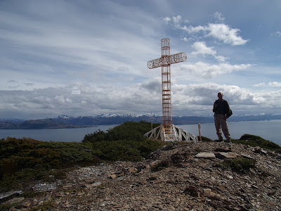
From Punta Arenas I take a bus south, as far as the small settlement of San Juan.  From here it is a... challenging 45km walk to Cabo Froward, but I do make it in less than two days.  The trail begins at a giant cross, with fine views across the Strait of Magellan towards the snowy mountains of Tierra del Fuego.  Now of course I need to retrace my steps, at least I know the worst.  Well, the cross is of course up a large hill, the descent is easier than the climb was, then a bit of pebbly beach - I'll be by the sea all the way to San Juan.  Sometimes of course there's a cliff where sea meets land, obviously this means a steep, muddy climb and descent.  It gets worse, a section of beach covered with fallen trees to climb over... well, that will do for what is left of the day, time to camp, and even make a fire.  I am probably not going to get fined here.

So you may be wondering, what is this 'Greater Patagonian Trail' then?  Well, it isn't any sort of official path, I don't know if I will see any signs.  Rather the whole thing seems to be the brainchild of one guy,  a German named Jan Dudeck.  Fair play to him, he's clearly spent an awful lot of time exploring Patagonia, and I hope to walk many of his routes - but that is the thing, 'routes'.  There isn't a continuous line, and not much at all here in the south, so for a while I will be following my own plan.  What can go wrong?

First full day of my route north, and I am still retracing my steps.  Lots more clambering over rocky coastline, and two rivers to cross - I had to swim both to get to Cabo Froward, not ideal this close to the Antarctic!  Today I swim the first, then for the second the tide is out, it's 'just' a waist deep wade.  At least the sun is out, in fact it is warm, t-shirt weather, although I was glad of all my warm gear in the tent last night.  The rest of the day is easy enough, a climb over a hill with actual bog, sandy beaches and pleasant paths through the forest.  With the lovely weather and fine views of the sea and mountains it is all rather splendid.

Another day and a bit more beach, to Faro San Isidro, the most southerly lighthouse on the mainland of course.  From here the route is better travelled, the beach is the same but the trails through the forest are easy now.  Then onto dirt road, for 10km to where I got off the bus, and a few km more.  Lots of holiday homes here, although not exactly deluxe - seems to be a popular idea to tow a broken down campervan here.  Well, onwards, I could of course just stay on this road, but surely I can do better... Well, I do have to climb a fence with 'privado' on it, sure it's fine though - there are certainly plenty of hiker footprints.  And glorious walking through natural parkland, then a steep ascent to an antenna around 400m up.  A footpath through the trees, then logging trails - one worry, my map shows a trail just stopping, the plan was to make my way off piste for a bit, but the trees look densely packed.  Fortunately the trail does not stop!  Time to camp then, tomorrow I'll see where it goes.

Well, the mystery trail takes me a little further, but then turns west, not good - I keep going but it doesn't turn north, OK, back I go, there is maybe a track leading north, looks like it hasn't been used in a while.  Of course a little later it vanishes entirely, I find myself struggling through dense undergrowth and masses of fallen branches, eventually I reach another logging track but it has been two hours and less than 4km along the route.  Next up, a track on my route turns out not to exist - there is just a fence leading into the trees... I see an alternative on the map, definitely showing as a minor road, but it is a fence too, sigh.  OK, decision time, the track I am on leads down to the coast road to Punta Arenas, so that is where I go.

It makes for a quick walk at least, although with endless fencing to either side it is not obvious where to camp - I find a spot by the beach in the end.  From here it is an easy morning's walk back to Punta Arenas, interesting though as I pass the rusting hulks of many large ships.  Good to be back in civilisation, and over a day early too, time for a nice rest then, and maybe some beer.